You are here: Home > Network List > AV - Alaska Volcano Observatory Stations List
> Station MAPS Pakushin Southeast, Makushin Volcano, Alaska > Earthquake Result Viewer
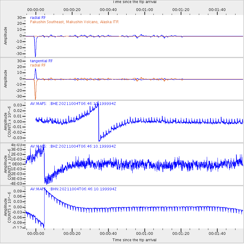
MAPS Pakushin Southeast, Makushin Volcano, Alaska - Earthquake Result Viewer
*The percent match for this event was below the threshold and hence no stack was calculated.
| Earthquake location: |
Kermadec Islands, New Zealand |
| Earthquake latitude/longitude: |
-30.0/-177.5 |
| Earthquake time(UTC): |
2021/10/04 (277) 06:34:14 GMT |
| Earthquake Depth: |
29 km |
| Earthquake Magnitude: |
5.5 Mww |
| Earthquake Catalog/Contributor: |
NEIC PDE/us |
|
| Network: |
AV Alaska Volcano Observatory |
| Station: |
MAPS Pakushin Southeast, Makushin Volcano, Alaska |
| Lat/Lon: |
53.81 N/166.94 W |
| Elevation: |
333 m |
|
| Distance: |
84.0 deg |
| Az: |
6.282 deg |
| Baz: |
189.209 deg |
| Ray Param: |
$rayparam |
*The percent match for this event was below the threshold and hence was not used in the summary stack. |
|
| Radial Match: |
96.85935 % |
| Radial Bump: |
213 |
| Transverse Match: |
96.69446 % |
| Transverse Bump: |
211 |
| SOD ConfigId: |
25131211 |
| Insert Time: |
2021-10-18 06:37:25.641 +0000 |
| GWidth: |
2.5 |
| Max Bumps: |
400 |
| Tol: |
0.001 |
|
Signal To Noise
| Channel | StoN | STA | LTA |
| AV:MAPS: :BHZ:20211004T06:46:10.199994Z | 4.2523365 | 2.3837345E-9 | 5.6057053E-10 |
| AV:MAPS: :BHN:20211004T06:46:10.199994Z | 7.737901 | 7.3548854E-8 | 9.505013E-9 |
| AV:MAPS: :BHE:20211004T06:46:10.199994Z | 6.9826684 | 2.3017662E-8 | 3.296399E-9 |
| Arrivals |
| Ps | |
| PpPs | |
| PsPs/PpSs | |


