You are here: Home > Network List > AV - Alaska Volcano Observatory Stations List
> Station SPU Mount Spurr, Mount Spurr, Alaska > Earthquake Result Viewer
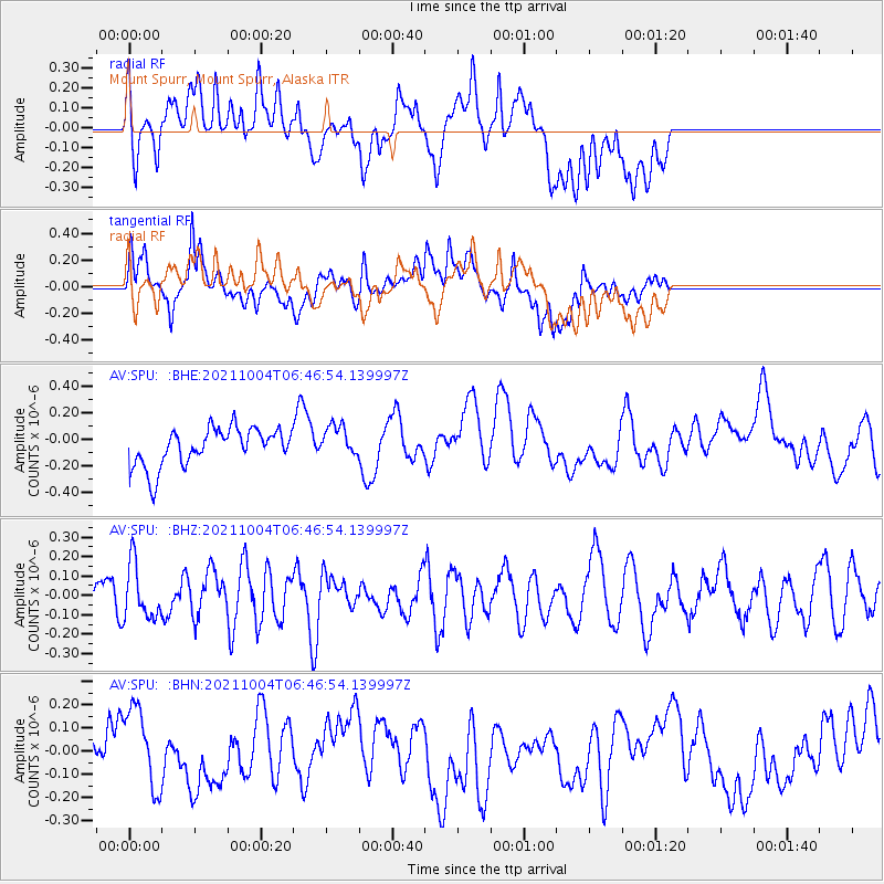
SPU Mount Spurr, Mount Spurr, Alaska - Earthquake Result Viewer
*The percent match for this event was below the threshold and hence no stack was calculated.
| Earthquake location: |
Kermadec Islands, New Zealand |
| Earthquake latitude/longitude: |
-30.0/-177.5 |
| Earthquake time(UTC): |
2021/10/04 (277) 06:34:14 GMT |
| Earthquake Depth: |
29 km |
| Earthquake Magnitude: |
5.5 Mww |
| Earthquake Catalog/Contributor: |
NEIC PDE/us |
|
| Network: |
AV Alaska Volcano Observatory |
| Station: |
SPU Mount Spurr, Mount Spurr, Alaska |
| Lat/Lon: |
61.18 N/152.06 W |
| Elevation: |
800 m |
|
| Distance: |
93.2 deg |
| Az: |
12.04 deg |
| Baz: |
201.927 deg |
| Ray Param: |
$rayparam |
*The percent match for this event was below the threshold and hence was not used in the summary stack. |
|
| Radial Match: |
37.936104 % |
| Radial Bump: |
400 |
| Transverse Match: |
44.644753 % |
| Transverse Bump: |
400 |
| SOD ConfigId: |
25131211 |
| Insert Time: |
2021-10-18 06:37:46.664 +0000 |
| GWidth: |
2.5 |
| Max Bumps: |
400 |
| Tol: |
0.001 |
|
Signal To Noise
| Channel | StoN | STA | LTA |
| AV:SPU: :BHZ:20211004T06:46:54.139997Z | 1.6963547 | 1.422599E-7 | 8.3862126E-8 |
| AV:SPU: :BHN:20211004T06:46:54.139997Z | 1.0641707 | 2.0083881E-7 | 1.88728E-7 |
| AV:SPU: :BHE:20211004T06:46:54.139997Z | 0.8390531 | 1.18798084E-7 | 1.4158589E-7 |
| Arrivals |
| Ps | |
| PpPs | |
| PsPs/PpSs | |


