You are here: Home > Network List > AZ - ANZA Regional Network Stations List
> Station SMER AZ.SMER > Earthquake Result Viewer
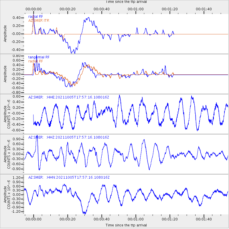
SMER AZ.SMER - Earthquake Result Viewer
*The percent match for this event was below the threshold and hence no stack was calculated.
| Earthquake location: |
Near East Coast Of Honshu, Japan |
| Earthquake latitude/longitude: |
40.1/142.3 |
| Earthquake time(UTC): |
2021/10/05 (278) 17:46:02 GMT |
| Earthquake Depth: |
45 km |
| Earthquake Magnitude: |
5.7 Mww |
| Earthquake Catalog/Contributor: |
NEIC PDE/us |
|
| Network: |
AZ ANZA Regional Network |
| Station: |
SMER AZ.SMER |
| Lat/Lon: |
33.46 N/117.17 W |
| Elevation: |
355 m |
|
| Distance: |
76.5 deg |
| Az: |
57.703 deg |
| Baz: |
309.118 deg |
| Ray Param: |
$rayparam |
*The percent match for this event was below the threshold and hence was not used in the summary stack. |
|
| Radial Match: |
49.47727 % |
| Radial Bump: |
400 |
| Transverse Match: |
50.237835 % |
| Transverse Bump: |
400 |
| SOD ConfigId: |
25131211 |
| Insert Time: |
2021-10-19 17:55:15.741 +0000 |
| GWidth: |
2.5 |
| Max Bumps: |
400 |
| Tol: |
0.001 |
|
Signal To Noise
| Channel | StoN | STA | LTA |
| AZ:SMER: :HHZ:20211005T17:57:16.108016Z | 2.386886 | 5.9159714E-7 | 2.478531E-7 |
| AZ:SMER: :HHN:20211005T17:57:16.108016Z | 1.2447195 | 5.3750966E-7 | 4.3183195E-7 |
| AZ:SMER: :HHE:20211005T17:57:16.108016Z | 0.8267838 | 2.1384606E-7 | 2.5864813E-7 |
| Arrivals |
| Ps | |
| PpPs | |
| PsPs/PpSs | |


