You are here: Home > Network List > CI - Caltech Regional Seismic Network Stations List
> Station MPM Manuel Prospect Mine, California, USA > Earthquake Result Viewer
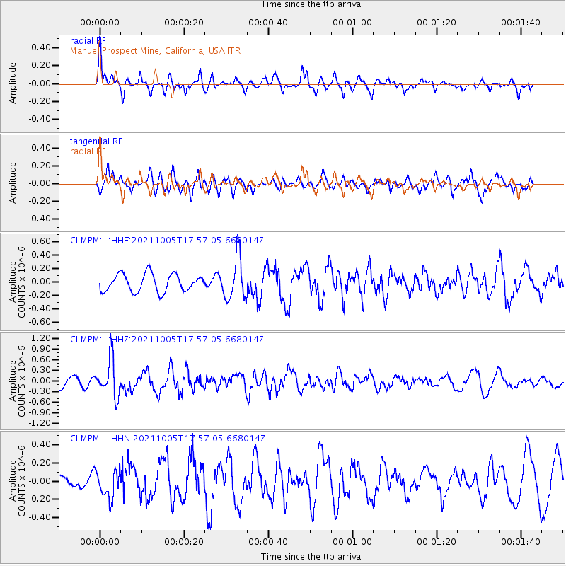
MPM Manuel Prospect Mine, California, USA - Earthquake Result Viewer
*The percent match for this event was below the threshold and hence no stack was calculated.
| Earthquake location: |
Near East Coast Of Honshu, Japan |
| Earthquake latitude/longitude: |
40.1/142.3 |
| Earthquake time(UTC): |
2021/10/05 (278) 17:46:02 GMT |
| Earthquake Depth: |
45 km |
| Earthquake Magnitude: |
5.7 Mww |
| Earthquake Catalog/Contributor: |
NEIC PDE/us |
|
| Network: |
CI Caltech Regional Seismic Network |
| Station: |
MPM Manuel Prospect Mine, California, USA |
| Lat/Lon: |
36.06 N/117.49 W |
| Elevation: |
185 m |
|
| Distance: |
74.6 deg |
| Az: |
55.784 deg |
| Baz: |
308.458 deg |
| Ray Param: |
$rayparam |
*The percent match for this event was below the threshold and hence was not used in the summary stack. |
|
| Radial Match: |
66.78139 % |
| Radial Bump: |
400 |
| Transverse Match: |
70.72682 % |
| Transverse Bump: |
400 |
| SOD ConfigId: |
25131211 |
| Insert Time: |
2021-10-19 17:58:18.314 +0000 |
| GWidth: |
2.5 |
| Max Bumps: |
400 |
| Tol: |
0.001 |
|
Signal To Noise
| Channel | StoN | STA | LTA |
| CI:MPM: :HHZ:20211005T17:57:05.668014Z | 3.2267156 | 5.4217236E-7 | 1.6802608E-7 |
| CI:MPM: :HHN:20211005T17:57:05.668014Z | 1.4276615 | 1.4965312E-7 | 1.04823954E-7 |
| CI:MPM: :HHE:20211005T17:57:05.668014Z | 2.4895263 | 3.1921496E-7 | 1.2822318E-7 |
| Arrivals |
| Ps | |
| PpPs | |
| PsPs/PpSs | |


