You are here: Home > Network List > CI - Caltech Regional Seismic Network Stations List
> Station TIN Tinemaha, Big Pine, CA, USA > Earthquake Result Viewer
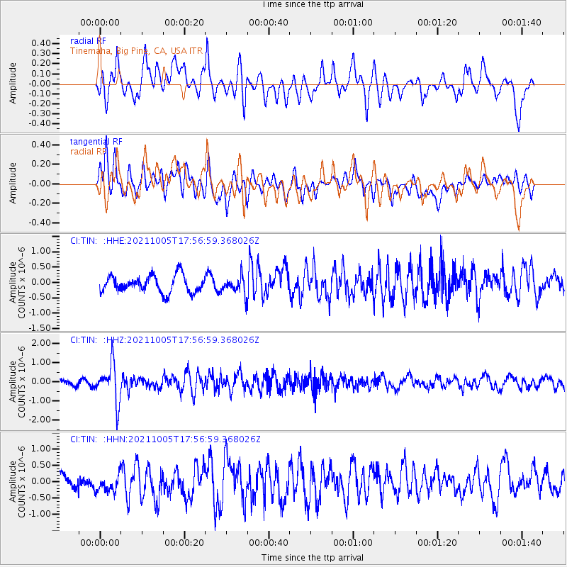
TIN Tinemaha, Big Pine, CA, USA - Earthquake Result Viewer
*The percent match for this event was below the threshold and hence no stack was calculated.
| Earthquake location: |
Near East Coast Of Honshu, Japan |
| Earthquake latitude/longitude: |
40.1/142.3 |
| Earthquake time(UTC): |
2021/10/05 (278) 17:46:02 GMT |
| Earthquake Depth: |
45 km |
| Earthquake Magnitude: |
5.7 Mww |
| Earthquake Catalog/Contributor: |
NEIC PDE/us |
|
| Network: |
CI Caltech Regional Seismic Network |
| Station: |
TIN Tinemaha, Big Pine, CA, USA |
| Lat/Lon: |
37.05 N/118.23 W |
| Elevation: |
1197 m |
|
| Distance: |
73.5 deg |
| Az: |
55.355 deg |
| Baz: |
307.901 deg |
| Ray Param: |
$rayparam |
*The percent match for this event was below the threshold and hence was not used in the summary stack. |
|
| Radial Match: |
77.90905 % |
| Radial Bump: |
400 |
| Transverse Match: |
69.846275 % |
| Transverse Bump: |
400 |
| SOD ConfigId: |
25131211 |
| Insert Time: |
2021-10-19 17:58:50.679 +0000 |
| GWidth: |
2.5 |
| Max Bumps: |
400 |
| Tol: |
0.001 |
|
Signal To Noise
| Channel | StoN | STA | LTA |
| CI:TIN: :HHZ:20211005T17:56:59.368026Z | 6.218222 | 1.0091026E-6 | 1.6228152E-7 |
| CI:TIN: :HHN:20211005T17:56:59.368026Z | 1.5638477 | 3.1747598E-7 | 2.0300953E-7 |
| CI:TIN: :HHE:20211005T17:56:59.368026Z | 1.0323172 | 2.834189E-7 | 2.7454632E-7 |
| Arrivals |
| Ps | |
| PpPs | |
| PsPs/PpSs | |


