PHID YL.PHID - Earthquake Result Viewer
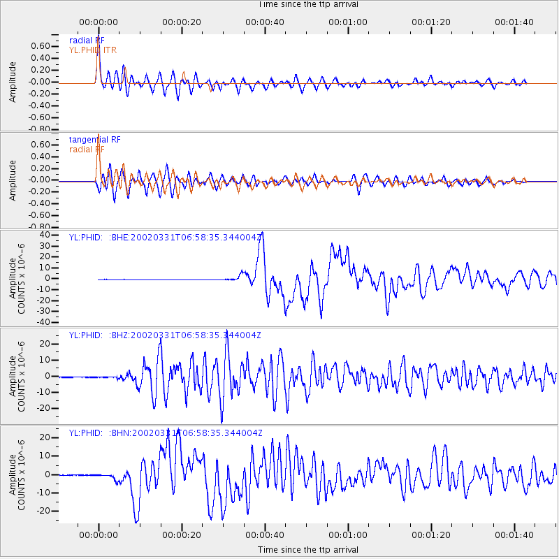
Earthquake location: Taiwan Region
Earthquake latitude/longitude: 24.3/122.2
Earthquake time(UTC): 2002/03/31 (090) 06:52:50 GMT
Earthquake Depth: 33 km
Earthquake Magnitude: 6.4 MB, 7.4 MS, 7.1 MW, 7.1 MW
Earthquake Catalog/Contributor: WHDF/NEIC
Network: YL Himalayan Nepal Tibet Experiment
Station: PHID YL.PHID
Lat/Lon: 27.15 N/87.76 E
Elevation: 1176 m
Distance: 31.1 deg
Az: 282.717 deg
Baz: 87.489 deg
Ray Param: 0.07913226
Estimated Moho Depth: 37.25 km
Estimated Crust Vp/Vs: 1.68
Assumed Crust Vp: 6.236 km/s
Estimated Crust Vs: 3.706 km/s
Estimated Crust Poisson's Ratio: 0.23
Radial Match: 92.07806 %
Radial Bump: 400
Transverse Match: 73.84783 %
Transverse Bump: 400
SOD ConfigId: 16820
Insert Time: 2010-02-26 16:03:34.604 +0000
GWidth: 2.5
Max Bumps: 400
Tol: 0.001

Signal To Noise

ChannelStoNSTALTA
YL:PHID: :BHZ:20020331T06:58:35.344004Z3.02272443.2589122E-71.0781373E-7
YL:PHID: :BHN:20020331T06:58:35.344004Z16.0729031.6791554E-61.04471205E-7
YL:PHID: :BHE:20020331T06:58:35.344004Z25.021112.7834756E-61.1124509E-7
Arrivals
Ps4.4 SECOND
PpPs15 SECOND
PsPs/PpSs19 SECOND