You are here: Home > Network List > CN - Canadian National Seismograph Network Stations List
> Station INK INUVIK, NT > Earthquake Result Viewer
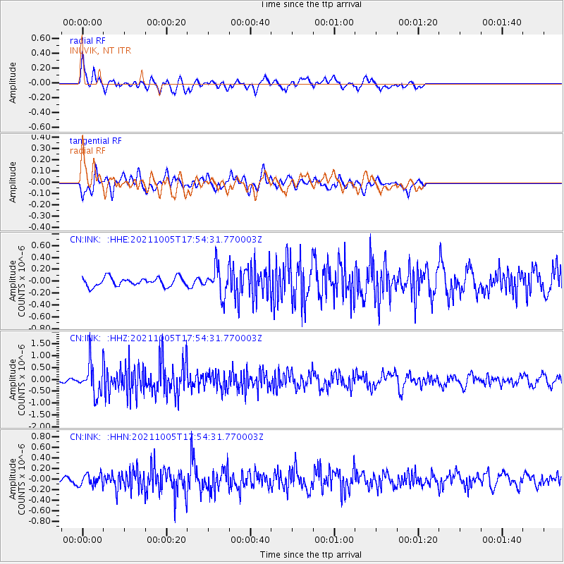
INK INUVIK, NT - Earthquake Result Viewer
*The percent match for this event was below the threshold and hence no stack was calculated.
| Earthquake location: |
Near East Coast Of Honshu, Japan |
| Earthquake latitude/longitude: |
40.1/142.3 |
| Earthquake time(UTC): |
2021/10/05 (278) 17:46:02 GMT |
| Earthquake Depth: |
45 km |
| Earthquake Magnitude: |
5.7 Mww |
| Earthquake Catalog/Contributor: |
NEIC PDE/us |
|
| Network: |
CN Canadian National Seismograph Network |
| Station: |
INK INUVIK, NT |
| Lat/Lon: |
68.31 N/133.53 W |
| Elevation: |
44 m |
|
| Distance: |
51.4 deg |
| Az: |
28.254 deg |
| Baz: |
282.318 deg |
| Ray Param: |
$rayparam |
*The percent match for this event was below the threshold and hence was not used in the summary stack. |
|
| Radial Match: |
73.42272 % |
| Radial Bump: |
400 |
| Transverse Match: |
61.846344 % |
| Transverse Bump: |
400 |
| SOD ConfigId: |
25131211 |
| Insert Time: |
2021-10-19 17:59:56.429 +0000 |
| GWidth: |
2.5 |
| Max Bumps: |
400 |
| Tol: |
0.001 |
|
Signal To Noise
| Channel | StoN | STA | LTA |
| CN:INK: :HHZ:20211005T17:54:31.770003Z | 6.068454 | 6.761587E-7 | 1.1142191E-7 |
| CN:INK: :HHN:20211005T17:54:31.770003Z | 0.9607504 | 1.03659154E-7 | 1.07893946E-7 |
| CN:INK: :HHE:20211005T17:54:31.770003Z | 3.3739545 | 2.44861E-7 | 7.257389E-8 |
| Arrivals |
| Ps | |
| PpPs | |
| PsPs/PpSs | |


