You are here: Home > Network List > US - United States National Seismic Network Stations List
> Station HAWA Hanford, Washington, USA > Earthquake Result Viewer
HAWA Hanford, Washington, USA - Earthquake Result Viewer
*The percent match for this event was below the threshold and hence no stack was calculated.
| Earthquake location: |
Near East Coast Of Honshu, Japan |
| Earthquake latitude/longitude: |
40.1/142.3 |
| Earthquake time(UTC): |
2021/10/05 (278) 17:46:02 GMT |
| Earthquake Depth: |
45 km |
| Earthquake Magnitude: |
5.7 Mww |
| Earthquake Catalog/Contributor: |
NEIC PDE/us |
|
| Network: |
US United States National Seismic Network |
| Station: |
HAWA Hanford, Washington, USA |
| Lat/Lon: |
46.39 N/119.53 W |
| Elevation: |
364 m |
|
| Distance: |
67.2 deg |
| Az: |
47.98 deg |
| Baz: |
304.552 deg |
| Ray Param: |
$rayparam |
*The percent match for this event was below the threshold and hence was not used in the summary stack. |
|
| Radial Match: |
39.618504 % |
| Radial Bump: |
400 |
| Transverse Match: |
77.22082 % |
| Transverse Bump: |
400 |
| SOD ConfigId: |
25131211 |
| Insert Time: |
2021-10-19 18:16:41.991 +0000 |
| GWidth: |
2.5 |
| Max Bumps: |
400 |
| Tol: |
0.001 |
|
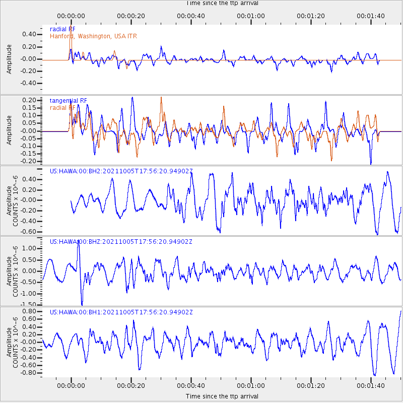
Signal To Noise
| Channel | StoN | STA | LTA |
| US:HAWA:00:BHZ:20211005T17:56:20.94902Z | 1.9250736 | 6.8623024E-7 | 3.5646963E-7 |
| US:HAWA:00:BH1:20211005T17:56:20.94902Z | 0.86497664 | 1.8324224E-7 | 2.1184644E-7 |
| US:HAWA:00:BH2:20211005T17:56:20.94902Z | 0.84076744 | 1.4909166E-7 | 1.7732808E-7 |
| Arrivals |
| Ps | |
| PpPs | |
| PsPs/PpSs | |


