You are here: Home > Network List > UW - Pacific Northwest Regional Seismic Network Stations List
> Station IRON Crane, OR, USA > Earthquake Result Viewer
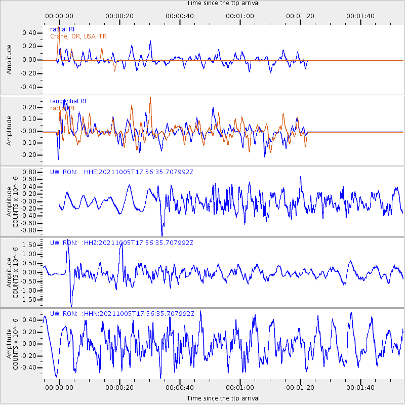
IRON Crane, OR, USA - Earthquake Result Viewer
*The percent match for this event was below the threshold and hence no stack was calculated.
| Earthquake location: |
Near East Coast Of Honshu, Japan |
| Earthquake latitude/longitude: |
40.1/142.3 |
| Earthquake time(UTC): |
2021/10/05 (278) 17:46:02 GMT |
| Earthquake Depth: |
45 km |
| Earthquake Magnitude: |
5.7 Mww |
| Earthquake Catalog/Contributor: |
NEIC PDE/us |
|
| Network: |
UW Pacific Northwest Regional Seismic Network |
| Station: |
IRON Crane, OR, USA |
| Lat/Lon: |
43.36 N/118.47 W |
| Elevation: |
1226 m |
|
| Distance: |
69.6 deg |
| Az: |
50.174 deg |
| Baz: |
306.104 deg |
| Ray Param: |
$rayparam |
*The percent match for this event was below the threshold and hence was not used in the summary stack. |
|
| Radial Match: |
59.194748 % |
| Radial Bump: |
400 |
| Transverse Match: |
68.62536 % |
| Transverse Bump: |
400 |
| SOD ConfigId: |
25131211 |
| Insert Time: |
2021-10-19 18:18:00.655 +0000 |
| GWidth: |
2.5 |
| Max Bumps: |
400 |
| Tol: |
0.001 |
|
Signal To Noise
| Channel | StoN | STA | LTA |
| UW:IRON: :HHZ:20211005T17:56:35.707992Z | 3.8493226 | 8.3800745E-7 | 2.1770258E-7 |
| UW:IRON: :HHN:20211005T17:56:35.707992Z | 0.8396949 | 2.6544265E-7 | 3.1611796E-7 |
| UW:IRON: :HHE:20211005T17:56:35.707992Z | 2.285111 | 3.8176222E-7 | 1.6706507E-7 |
| Arrivals |
| Ps | |
| PpPs | |
| PsPs/PpSs | |


