PHID YL.PHID - Earthquake Result Viewer
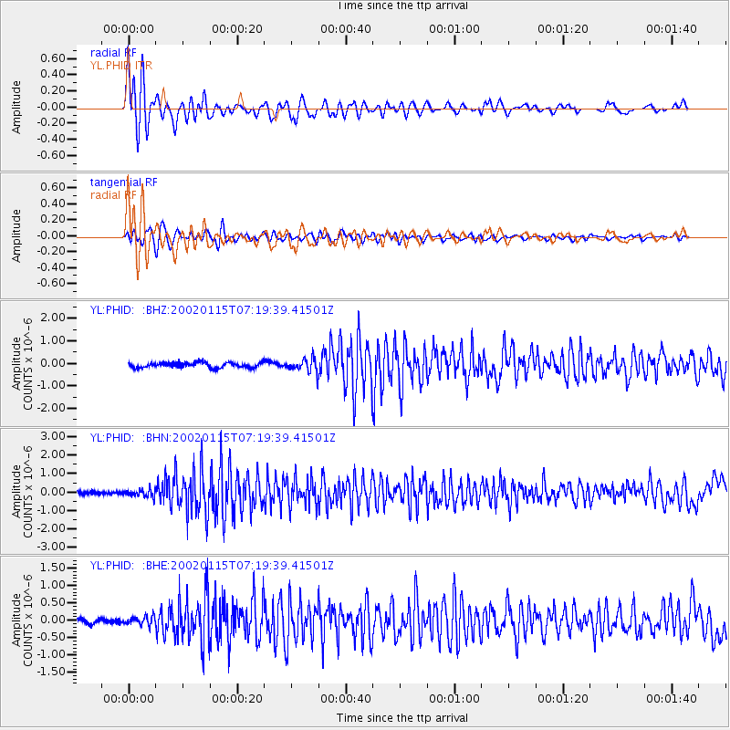
Earthquake location: Sunda Strait, Indonesia
Earthquake latitude/longitude: -6.3/105.2
Earthquake time(UTC): 2002/01/15 (015) 07:12:58 GMT
Earthquake Depth: 10 km
Earthquake Magnitude: 5.8 MB, 6.3 MS, 6.2 MW, 6.1 MW
Earthquake Catalog/Contributor: WHDF/NEIC
Network: YL Himalayan Nepal Tibet Experiment
Station: PHID YL.PHID
Lat/Lon: 27.15 N/87.76 E
Elevation: 1176 m
Distance: 37.3 deg
Az: 333.855 deg
Baz: 150.557 deg
Ray Param: 0.07620796
Estimated Moho Depth: 25.25 km
Estimated Crust Vp/Vs: 1.60
Assumed Crust Vp: 6.236 km/s
Estimated Crust Vs: 3.897 km/s
Estimated Crust Poisson's Ratio: 0.18
Radial Match: 85.208336 %
Radial Bump: 400
Transverse Match: 75.74533 %
Transverse Bump: 400
SOD ConfigId: 16820
Insert Time: 2010-02-26 16:03:50.016 +0000
GWidth: 2.5
Max Bumps: 400
Tol: 0.001

Signal To Noise

ChannelStoNSTALTA
YL:PHID: :BHN:20020115T07:19:39.41501Z1.88433471.9521329E-71.0359799E-7
YL:PHID: :BHE:20020115T07:19:39.41501Z1.93075541.201714E-76.2240616E-8
YL:PHID: :BHZ:20020115T07:19:39.41501Z2.58942532.9679134E-71.1461668E-7
Arrivals
Ps2.6 SECOND
PpPs9.7 SECOND
PsPs/PpSs12 SECOND