You are here: Home > Network List > TA - USArray Transportable Network (new EarthScope stations) Stations List
> Station TUL3 Leonard, OK, USA > Earthquake Result Viewer
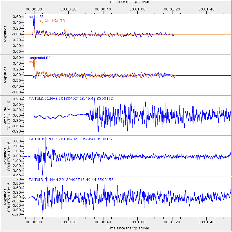
TUL3 Leonard, OK, USA - Earthquake Result Viewer
*The percent match for this event was below the threshold and hence no stack was calculated.
| Earthquake location: |
Southern Bolivia |
| Earthquake latitude/longitude: |
-20.7/-63.0 |
| Earthquake time(UTC): |
2018/04/02 (092) 13:40:34 GMT |
| Earthquake Depth: |
562 km |
| Earthquake Magnitude: |
6.8 Mww |
| Earthquake Catalog/Contributor: |
NEIC PDE/us |
|
| Network: |
TA USArray Transportable Network (new EarthScope stations) |
| Station: |
TUL3 Leonard, OK, USA |
| Lat/Lon: |
35.91 N/95.79 W |
| Elevation: |
265 m |
|
| Distance: |
64.2 deg |
| Az: |
330.796 deg |
| Baz: |
145.744 deg |
| Ray Param: |
$rayparam |
*The percent match for this event was below the threshold and hence was not used in the summary stack. |
|
| Radial Match: |
79.55994 % |
| Radial Bump: |
400 |
| Transverse Match: |
58.527267 % |
| Transverse Bump: |
400 |
| SOD ConfigId: |
2643891 |
| Insert Time: |
2018-04-16 13:48:04.939 +0000 |
| GWidth: |
2.5 |
| Max Bumps: |
400 |
| Tol: |
0.001 |
|
Signal To Noise
| Channel | StoN | STA | LTA |
| TA:TUL3:01:HHZ:20180402T13:49:44.350015Z | 19.73669 | 8.314949E-7 | 4.2129397E-8 |
| TA:TUL3:01:HHN:20180402T13:49:44.350015Z | 4.051496 | 1.8900154E-7 | 4.6649816E-8 |
| TA:TUL3:01:HHE:20180402T13:49:44.350015Z | 2.9621482 | 1.9228031E-7 | 6.4912456E-8 |
| Arrivals |
| Ps | |
| PpPs | |
| PsPs/PpSs | |


