
PHID YL.PHID - Earthquake Result Viewer
| ||||||||||||||||||
| ||||||||||||||||||
| ||||||||||||||||||
|
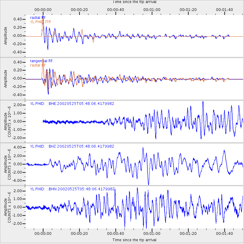
Signal To Noise
| Channel | StoN | STA | LTA |
| YL:PHID: :BHZ:20020525T05:48:06.417998Z | 4.9629364 | 4.483175E-7 | 9.033311E-8 |
| YL:PHID: :BHN:20020525T05:48:06.417998Z | 1.514878 | 1.7735226E-7 | 1.1707363E-7 |
| YL:PHID: :BHE:20020525T05:48:06.417998Z | 1.1172025 | 9.945114E-8 | 8.9018E-8 |
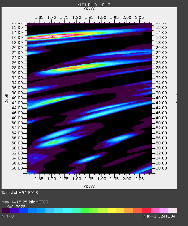
| Arrivals | |
| Ps | 1.8 SECOND |
| PpPs | 6.4 SECOND |
| PsPs/PpSs | 8.2 SECOND |

