You are here: Home > Network List > AV - Alaska Volcano Observatory Stations List
> Station TAPA Point Aries, Tanaga Volcano, Alaska > Earthquake Result Viewer
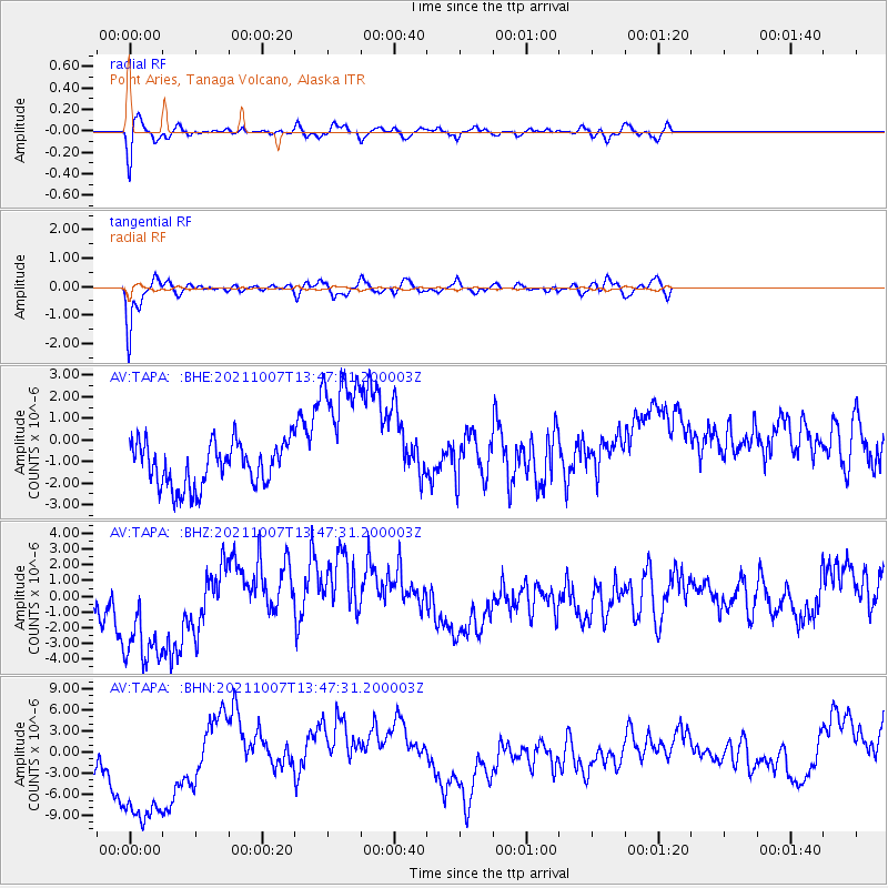
TAPA Point Aries, Tanaga Volcano, Alaska - Earthquake Result Viewer
*The percent match for this event was below the threshold and hence no stack was calculated.
| Earthquake location: |
Near East Coast Of Honshu, Japan |
| Earthquake latitude/longitude: |
35.6/140.1 |
| Earthquake time(UTC): |
2021/10/07 (280) 13:41:24 GMT |
| Earthquake Depth: |
62 km |
| Earthquake Magnitude: |
5.9 mww |
| Earthquake Catalog/Contributor: |
NEIC PDE/us |
|
| Network: |
AV Alaska Volcano Observatory |
| Station: |
TAPA Point Aries, Tanaga Volcano, Alaska |
| Lat/Lon: |
51.81 N/177.81 W |
| Elevation: |
640 m |
|
| Distance: |
33.9 deg |
| Az: |
48.17 deg |
| Baz: |
258.121 deg |
| Ray Param: |
$rayparam |
*The percent match for this event was below the threshold and hence was not used in the summary stack. |
|
| Radial Match: |
74.97512 % |
| Radial Bump: |
400 |
| Transverse Match: |
88.32076 % |
| Transverse Bump: |
400 |
| SOD ConfigId: |
25131211 |
| Insert Time: |
2021-10-21 13:49:28.303 +0000 |
| GWidth: |
2.5 |
| Max Bumps: |
400 |
| Tol: |
0.001 |
|
Signal To Noise
| Channel | StoN | STA | LTA |
| AV:TAPA: :BHZ:20211007T13:47:31.200003Z | 3.420397 | 4.777203E-6 | 1.3966808E-6 |
| AV:TAPA: :BHN:20211007T13:47:31.200003Z | 2.9497337 | 1.2265614E-5 | 4.1582107E-6 |
| AV:TAPA: :BHE:20211007T13:47:31.200003Z | 3.335749 | 3.336175E-6 | 1.0001278E-6 |
| Arrivals |
| Ps | |
| PpPs | |
| PsPs/PpSs | |


