PHID YL.PHID - Earthquake Result Viewer
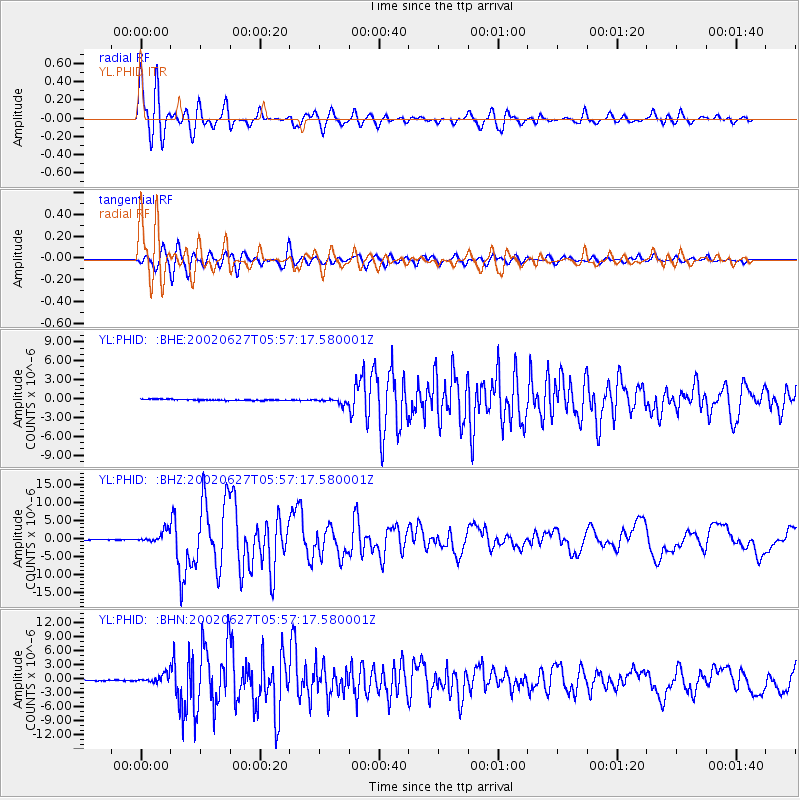
Earthquake location: Sunda Strait, Indonesia
Earthquake latitude/longitude: -7.0/104.2
Earthquake time(UTC): 2002/06/27 (178) 05:50:35 GMT
Earthquake Depth: 11 km
Earthquake Magnitude: 6.0 MB, 6.9 MS, 6.6 MW, 6.5 MW
Earthquake Catalog/Contributor: WHDF/NEIC
Network: YL Himalayan Nepal Tibet Experiment
Station: PHID YL.PHID
Lat/Lon: 27.15 N/87.76 E
Elevation: 1176 m
Distance: 37.5 deg
Az: 335.537 deg
Baz: 152.525 deg
Ray Param: 0.07612485
Estimated Moho Depth: 25.0 km
Estimated Crust Vp/Vs: 1.61
Assumed Crust Vp: 6.236 km/s
Estimated Crust Vs: 3.879 km/s
Estimated Crust Poisson's Ratio: 0.18
Radial Match: 84.96268 %
Radial Bump: 400
Transverse Match: 83.09292 %
Transverse Bump: 400
SOD ConfigId: 16844
Insert Time: 2010-02-26 16:04:08.657 +0000
GWidth: 2.5
Max Bumps: 400
Tol: 0.001

Signal To Noise

ChannelStoNSTALTA
YL:PHID: :BHZ:20020627T05:57:17.580001Z16.5457121.5833301E-69.569429E-8
YL:PHID: :BHN:20020627T05:57:17.580001Z9.68119059.708639E-71.00283515E-7
YL:PHID: :BHE:20020627T05:57:17.580001Z4.51954134.3518202E-79.628898E-8
Arrivals
Ps2.6 SECOND
PpPs9.7 SECOND
PsPs/PpSs12 SECOND