COLD Coldfoot Broadband - Earthquake Result Viewer
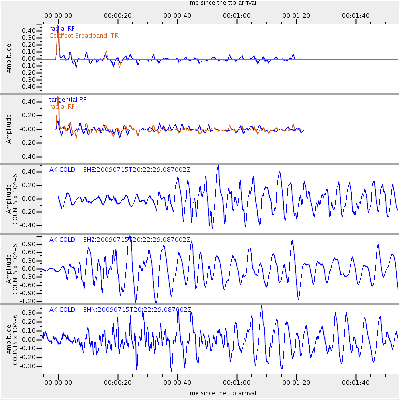
Earthquake location: New Ireland Region, P.N.G.
Earthquake latitude/longitude: -3.4/150.5
Earthquake time(UTC): 2009/07/15 (196) 20:10:42 GMT
Earthquake Depth: 13 km
Earthquake Magnitude: 5.6 MB, 6.1 MS, 6.1 MW, 6.1 MW
Earthquake Catalog/Contributor: WHDF/NEIC
Network: AK Alaska Regional Network
Station: COLD Coldfoot Broadband
Lat/Lon: 67.23 N/150.20 W
Elevation: 377 m
Distance: 81.7 deg
Az: 19.771 deg
Baz: 240.161 deg
Ray Param: 0.047405694
Estimated Moho Depth: 10.0 km
Estimated Crust Vp/Vs: 2.09
Assumed Crust Vp: 6.577 km/s
Estimated Crust Vs: 3.154 km/s
Estimated Crust Poisson's Ratio: 0.35
Radial Match: 93.03138 %
Radial Bump: 281
Transverse Match: 81.37223 %
Transverse Bump: 400
SOD ConfigId: 2648
Insert Time: 2010-03-09 13:26:21.578 +0000
GWidth: 2.5
Max Bumps: 400
Tol: 0.001

Signal To Noise

ChannelStoNSTALTA
AK:COLD: :BHZ:20090715T20:22:29.087002Z2.57972341.3298252E-75.1549144E-8
AK:COLD: :BHN:20090715T20:22:29.087002Z0.650289363.4662122E-85.3302614E-8
AK:COLD: :BHE:20090715T20:22:29.087002Z1.31628796.5138344E-84.94864E-8
Arrivals
Ps1.7 SECOND
PpPs4.6 SECOND
PsPs/PpSs6.3 SECOND