
PHID YL.PHID - Earthquake Result Viewer
| ||||||||||||||||||
| ||||||||||||||||||
| ||||||||||||||||||
|
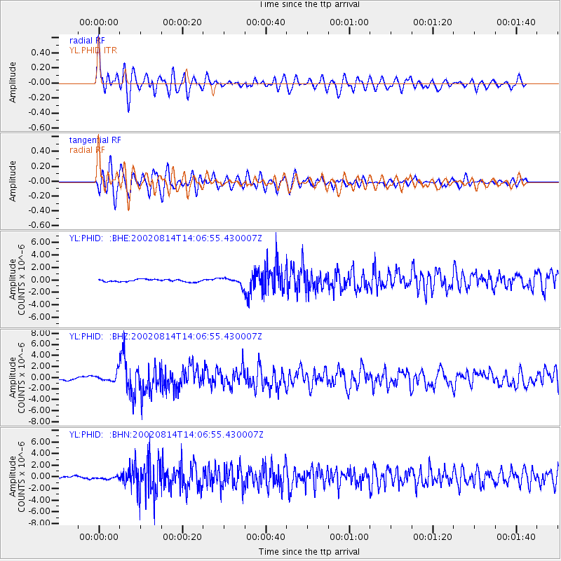
Signal To Noise
| Channel | StoN | STA | LTA |
| YL:PHID: :BHZ:20020814T14:06:55.430007Z | 4.133727 | 7.823168E-7 | 1.8925218E-7 |
| YL:PHID: :BHN:20020814T14:06:55.430007Z | 1.3912219 | 2.267524E-7 | 1.6298794E-7 |
| YL:PHID: :BHE:20020814T14:06:55.430007Z | 3.2374687 | 6.0270276E-7 | 1.8616481E-7 |
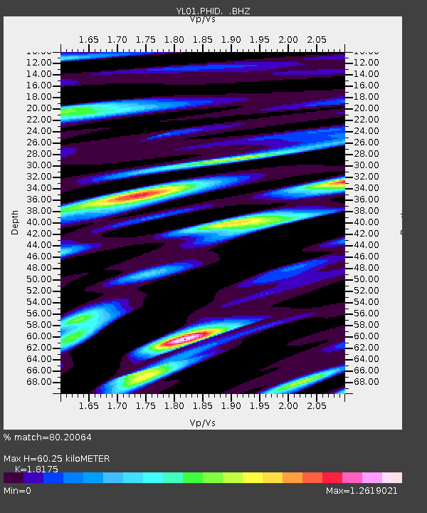
| Arrivals | |
| Ps | 8.3 SECOND |
| PpPs | 26 SECOND |
| PsPs/PpSs | 34 SECOND |

