
COLD Coldfoot Broadband - Earthquake Result Viewer
| ||||||||||||||||||
| ||||||||||||||||||
| ||||||||||||||||||
|
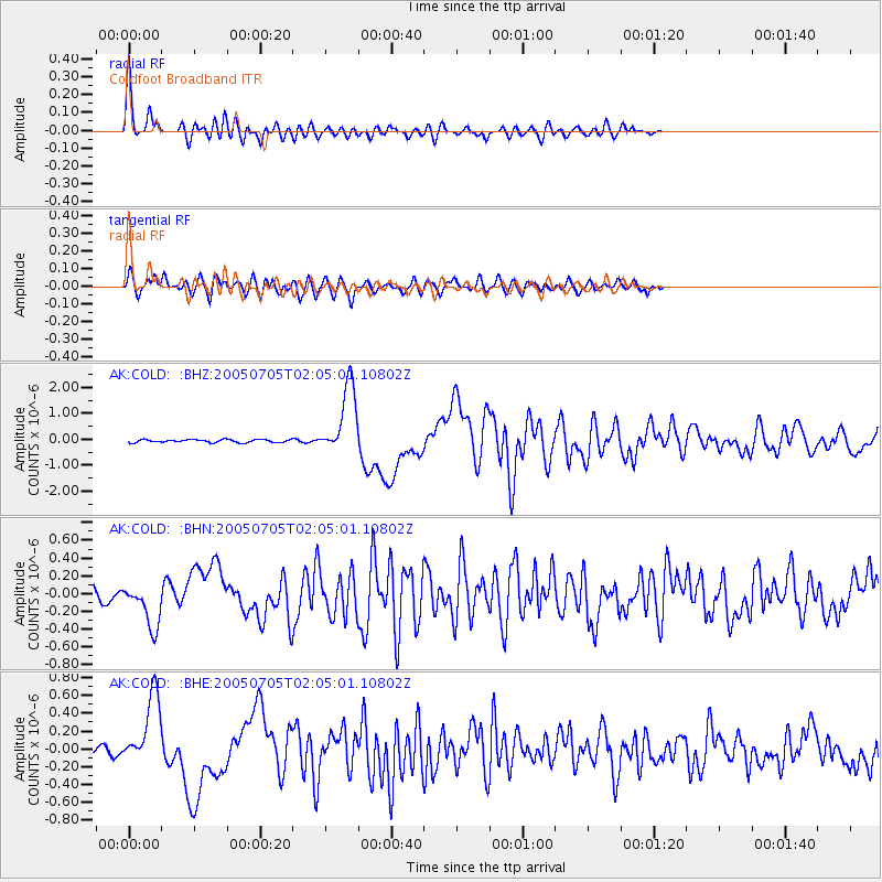
Signal To Noise
| Channel | StoN | STA | LTA |
| AK:COLD: :BHN:20050705T02:05:01.10802Z | 6.087015 | 2.5183925E-7 | 4.1373195E-8 |
| AK:COLD: :BHE:20050705T02:05:01.10802Z | 12.663498 | 4.1954837E-7 | 3.313053E-8 |
| AK:COLD: :BHZ:20050705T02:05:01.10802Z | 23.798939 | 1.3512504E-6 | 5.6777754E-8 |
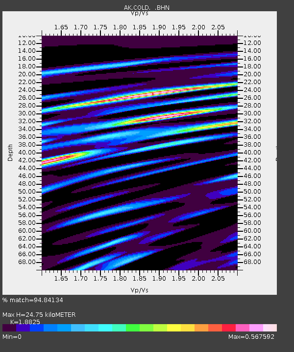
| Arrivals | |
| Ps | 3.4 SECOND |
| PpPs | 11 SECOND |
| PsPs/PpSs | 14 SECOND |

