You are here: Home > Network List > US - United States National Seismic Network Stations List
> Station DGMT Dagmar, Montana, USA > Earthquake Result Viewer
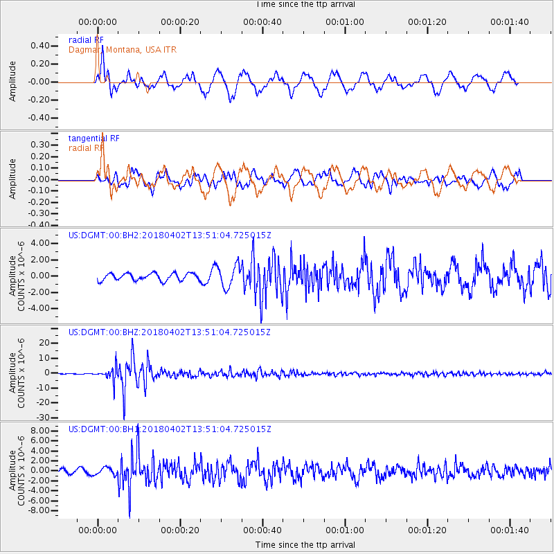
DGMT Dagmar, Montana, USA - Earthquake Result Viewer
*The percent match for this event was below the threshold and hence no stack was calculated.
| Earthquake location: |
Southern Bolivia |
| Earthquake latitude/longitude: |
-20.7/-63.0 |
| Earthquake time(UTC): |
2018/04/02 (092) 13:40:34 GMT |
| Earthquake Depth: |
562 km |
| Earthquake Magnitude: |
6.8 Mww |
| Earthquake Catalog/Contributor: |
NEIC PDE/us |
|
| Network: |
US United States National Seismic Network |
| Station: |
DGMT Dagmar, Montana, USA |
| Lat/Lon: |
48.47 N/104.20 W |
| Elevation: |
0.0 m |
|
| Distance: |
78.0 deg |
| Az: |
333.39 deg |
| Baz: |
140.927 deg |
| Ray Param: |
$rayparam |
*The percent match for this event was below the threshold and hence was not used in the summary stack. |
|
| Radial Match: |
71.67008 % |
| Radial Bump: |
400 |
| Transverse Match: |
72.10656 % |
| Transverse Bump: |
400 |
| SOD ConfigId: |
2643891 |
| Insert Time: |
2018-04-16 13:49:58.562 +0000 |
| GWidth: |
2.5 |
| Max Bumps: |
400 |
| Tol: |
0.001 |
|
Signal To Noise
| Channel | StoN | STA | LTA |
| US:DGMT:00:BHZ:20180402T13:51:04.725015Z | 25.194506 | 4.5219244E-6 | 1.7948058E-7 |
| US:DGMT:00:BH1:20180402T13:51:04.725015Z | 1.3367662 | 7.0098224E-7 | 5.2438656E-7 |
| US:DGMT:00:BH2:20180402T13:51:04.725015Z | 3.1004174 | 1.346969E-6 | 4.3444766E-7 |
| Arrivals |
| Ps | |
| PpPs | |
| PsPs/PpSs | |


