You are here: Home > Network List > IW - Intermountain West Stations List
> Station MOOW Moose Ponds, Wyoming, USA > Earthquake Result Viewer
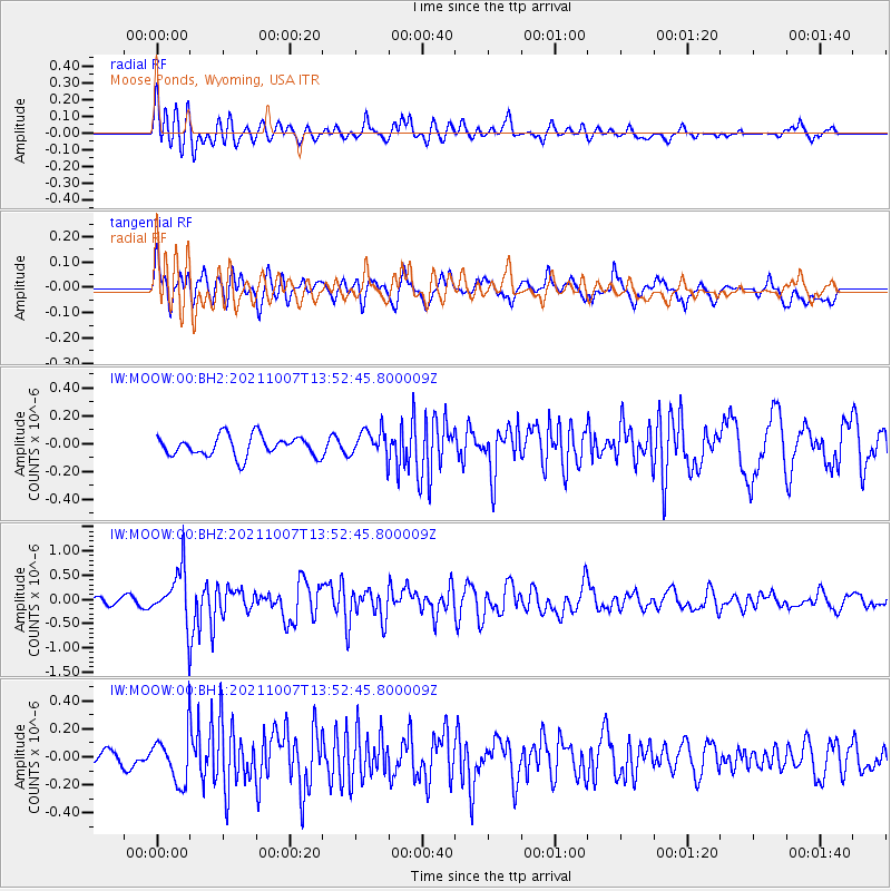
MOOW Moose Ponds, Wyoming, USA - Earthquake Result Viewer
*The percent match for this event was below the threshold and hence no stack was calculated.
| Earthquake location: |
Near East Coast Of Honshu, Japan |
| Earthquake latitude/longitude: |
35.6/140.1 |
| Earthquake time(UTC): |
2021/10/07 (280) 13:41:24 GMT |
| Earthquake Depth: |
62 km |
| Earthquake Magnitude: |
5.9 mww |
| Earthquake Catalog/Contributor: |
NEIC PDE/us |
|
| Network: |
IW Intermountain West |
| Station: |
MOOW Moose Ponds, Wyoming, USA |
| Lat/Lon: |
43.75 N/110.74 W |
| Elevation: |
2128 m |
|
| Distance: |
78.2 deg |
| Az: |
44.386 deg |
| Baz: |
308.102 deg |
| Ray Param: |
$rayparam |
*The percent match for this event was below the threshold and hence was not used in the summary stack. |
|
| Radial Match: |
73.19985 % |
| Radial Bump: |
400 |
| Transverse Match: |
61.660652 % |
| Transverse Bump: |
400 |
| SOD ConfigId: |
25131211 |
| Insert Time: |
2021-10-21 13:59:22.978 +0000 |
| GWidth: |
2.5 |
| Max Bumps: |
400 |
| Tol: |
0.001 |
|
Signal To Noise
| Channel | StoN | STA | LTA |
| IW:MOOW:00:BHZ:20211007T13:52:45.800009Z | 6.322789 | 5.621061E-7 | 8.89016E-8 |
| IW:MOOW:00:BH1:20211007T13:52:45.800009Z | 2.3021817 | 1.7911054E-7 | 7.7800344E-8 |
| IW:MOOW:00:BH2:20211007T13:52:45.800009Z | 1.3552022 | 9.8950906E-8 | 7.3015606E-8 |
| Arrivals |
| Ps | |
| PpPs | |
| PsPs/PpSs | |


