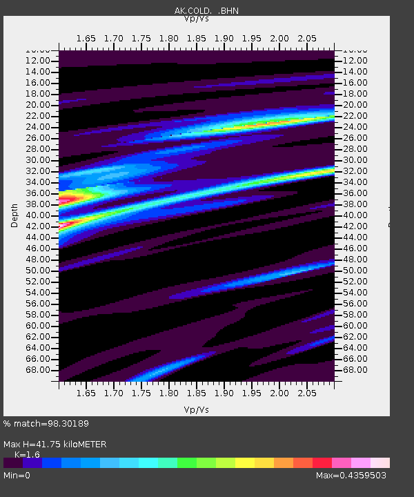
COLD Coldfoot Broadband - Earthquake Result Viewer

Earthquake location: Northern Sumatra, Indonesia
Earthquake latitude/longitude: 2.1/97.1
Earthquake time(UTC): 2005/03/28 (087) 16:09:36 GMT
Earthquake Depth: 30 km
Earthquake Magnitude: 7.2 MB, 8.4 MS, 8.7 MW, 8.1 MW
Earthquake Catalog/Contributor: WHDF/NEIC
Network: AK Alaska Regional Network
Station: COLD Coldfoot Broadband
Lat/Lon: 67.23 N/150.20 W
Elevation: 377 m
Distance: 96.7 deg
Az: 21.201 deg
Baz: 291.821 deg
Ray Param: 0.04042082
Estimated Moho Depth: 41.75 km
Estimated Crust Vp/Vs: 1.60
Assumed Crust Vp: 6.577 km/s
Estimated Crust Vs: 4.11 km/s
Estimated Crust Poisson's Ratio: 0.18
Radial Match: 98.30189 %
Radial Bump: 205
Transverse Match: 81.08683 %
Transverse Bump: 400
SOD ConfigId: 2459
Insert Time: 2010-03-09 13:26:59.397 +0000
GWidth: 2.5
Max Bumps: 400
Tol: 0.001

Signal To Noise

ChannelStoNSTALTA
AK:COLD: :BHN:20050328T16:22:32.407014Z2.07148841.6355467E-77.8955146E-8
AK:COLD: :BHE:20050328T16:22:32.407014Z3.71260624.5197262E-71.2173999E-7
AK:COLD: :BHZ:20050328T16:22:32.407014Z5.1094738.901241E-71.7421054E-7
Arrivals
Ps3.9 SECOND
PpPs16 SECOND
PsPs/PpSs20 SECOND