COLD Coldfoot Broadband - Earthquake Result Viewer
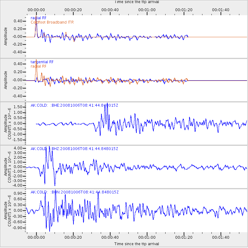
Earthquake location: Xizang
Earthquake latitude/longitude: 29.8/90.3
Earthquake time(UTC): 2008/10/06 (280) 08:30:45 GMT
Earthquake Depth: 12 km
Earthquake Magnitude: 6.0 MB, 6.2 MS, 6.3 MW, 6.3 MW
Earthquake Catalog/Contributor: WHDF/NEIC
Network: AK Alaska Regional Network
Station: COLD Coldfoot Broadband
Lat/Lon: 67.23 N/150.20 W
Elevation: 377 m
Distance: 73.2 deg
Az: 20.74 deg
Baz: 307.756 deg
Ray Param: 0.053163763
Estimated Moho Depth: 35.5 km
Estimated Crust Vp/Vs: 1.76
Assumed Crust Vp: 6.577 km/s
Estimated Crust Vs: 3.737 km/s
Estimated Crust Poisson's Ratio: 0.26
Radial Match: 90.75332 %
Radial Bump: 400
Transverse Match: 75.02874 %
Transverse Bump: 400
SOD ConfigId: 2560
Insert Time: 2010-03-09 13:27:16.577 +0000
GWidth: 2.5
Max Bumps: 400
Tol: 0.001

Signal To Noise

ChannelStoNSTALTA
AK:COLD: :BHZ:20081006T08:41:44.848015Z21.0422421.1639743E-65.5316075E-8
AK:COLD: :BHN:20081006T08:41:44.848015Z4.51936152.802786E-76.201731E-8
AK:COLD: :BHE:20081006T08:41:44.848015Z5.4011353.7485532E-76.9403065E-8
Arrivals
Ps4.3 SECOND
PpPs14 SECOND
PsPs/PpSs19 SECOND