PHID YL.PHID - Earthquake Result Viewer
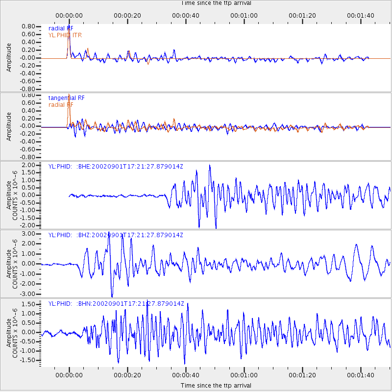
Earthquake location: Eastern Gulf Of Aden
Earthquake latitude/longitude: 14.3/51.9
Earthquake time(UTC): 2002/09/01 (244) 17:14:59 GMT
Earthquake Depth: 10 km
Earthquake Magnitude: 5.8 MS, 5.2 MB, 6.0 MW, 6.0 MW
Earthquake Catalog/Contributor: WHDF/NEIC
Network: YL Himalayan Nepal Tibet Experiment
Station: PHID YL.PHID
Lat/Lon: 27.15 N/87.76 E
Elevation: 1176 m
Distance: 35.7 deg
Az: 63.245 deg
Baz: 256.296 deg
Ray Param: 0.077064924
Estimated Moho Depth: 20.0 km
Estimated Crust Vp/Vs: 1.98
Assumed Crust Vp: 6.236 km/s
Estimated Crust Vs: 3.153 km/s
Estimated Crust Poisson's Ratio: 0.33
Radial Match: 81.76198 %
Radial Bump: 400
Transverse Match: 74.61642 %
Transverse Bump: 400
SOD ConfigId: 16844
Insert Time: 2010-02-26 16:04:21.629 +0000
GWidth: 2.5
Max Bumps: 400
Tol: 0.001

Signal To Noise

ChannelStoNSTALTA
YL:PHID: :BHZ:20020901T17:21:27.879014Z7.07931334.5636617E-76.446475E-8
YL:PHID: :BHN:20020901T17:21:27.879014Z1.43857038.709587E-86.054336E-8
YL:PHID: :BHE:20020901T17:21:27.879014Z6.37116532.6477352E-74.1558103E-8
Arrivals
Ps3.3 SECOND
PpPs9.0 SECOND
PsPs/PpSs12 SECOND