
COLD Coldfoot Broadband - Earthquake Result Viewer
| ||||||||||||||||||
| ||||||||||||||||||
| ||||||||||||||||||
|
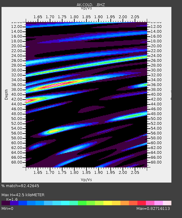
Signal To Noise
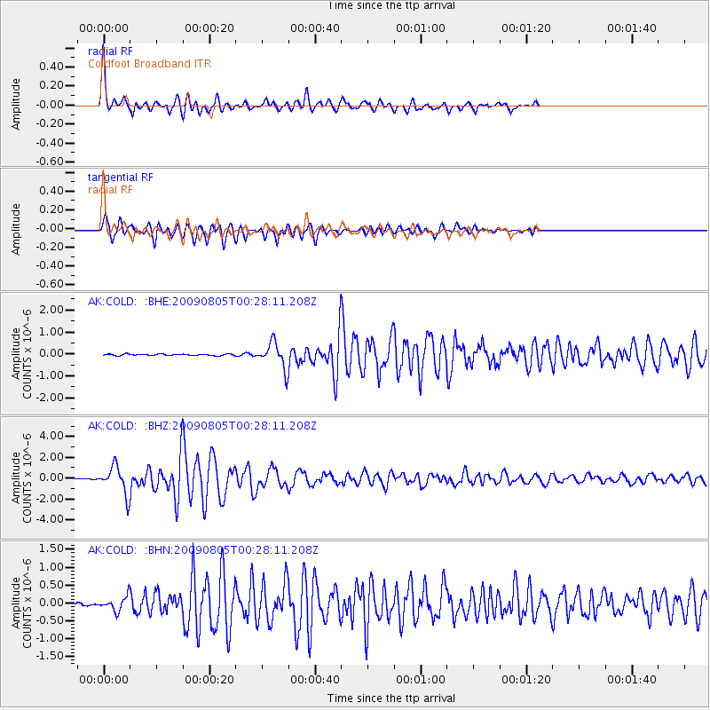
| Channel | StoN | STA | LTA |
| AK:COLD: :BHZ:20090805T00:28:11.208Z | 28.13286 | 1.3388639E-6 | 4.759075E-8 |
| AK:COLD: :BHN:20090805T00:28:11.208Z | 5.0282083 | 1.9222954E-7 | 3.8230226E-8 |
| AK:COLD: :BHE:20090805T00:28:11.208Z | 16.682552 | 5.8030736E-7 | 3.4785284E-8 |
| Arrivals | |
| Ps | 4.1 SECOND |
| PpPs | 16 SECOND |
| PsPs/PpSs | 20 SECOND |

