You are here: Home > Network List > US - United States National Seismic Network Stations List
> Station AMTX Amarillo, Texas, USA > Earthquake Result Viewer
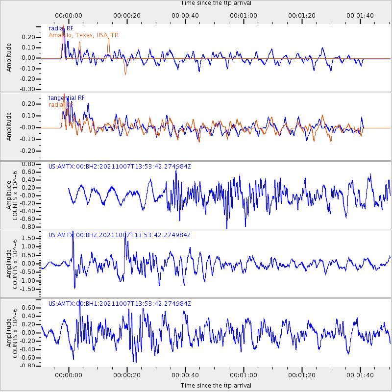
AMTX Amarillo, Texas, USA - Earthquake Result Viewer
*The percent match for this event was below the threshold and hence no stack was calculated.
| Earthquake location: |
Near East Coast Of Honshu, Japan |
| Earthquake latitude/longitude: |
35.6/140.1 |
| Earthquake time(UTC): |
2021/10/07 (280) 13:41:24 GMT |
| Earthquake Depth: |
62 km |
| Earthquake Magnitude: |
5.9 mww |
| Earthquake Catalog/Contributor: |
NEIC PDE/us |
|
| Network: |
US United States National Seismic Network |
| Station: |
AMTX Amarillo, Texas, USA |
| Lat/Lon: |
34.53 N/101.41 W |
| Elevation: |
1010 m |
|
| Distance: |
89.7 deg |
| Az: |
46.524 deg |
| Baz: |
314.226 deg |
| Ray Param: |
$rayparam |
*The percent match for this event was below the threshold and hence was not used in the summary stack. |
|
| Radial Match: |
53.159523 % |
| Radial Bump: |
400 |
| Transverse Match: |
60.893158 % |
| Transverse Bump: |
400 |
| SOD ConfigId: |
25131211 |
| Insert Time: |
2021-10-21 14:08:55.653 +0000 |
| GWidth: |
2.5 |
| Max Bumps: |
400 |
| Tol: |
0.001 |
|
Signal To Noise
| Channel | StoN | STA | LTA |
| US:AMTX:00:BHZ:20211007T13:53:42.274984Z | 3.4595523 | 6.4079063E-7 | 1.8522357E-7 |
| US:AMTX:00:BH1:20211007T13:53:42.274984Z | 2.3059716 | 3.3395253E-7 | 1.4482075E-7 |
| US:AMTX:00:BH2:20211007T13:53:42.274984Z | 1.3785552 | 2.0389584E-7 | 1.4790547E-7 |
| Arrivals |
| Ps | |
| PpPs | |
| PsPs/PpSs | |


