You are here: Home > Network List > US - United States National Seismic Network Stations List
> Station MNTX Cornudas Mountains, Texas, USA > Earthquake Result Viewer
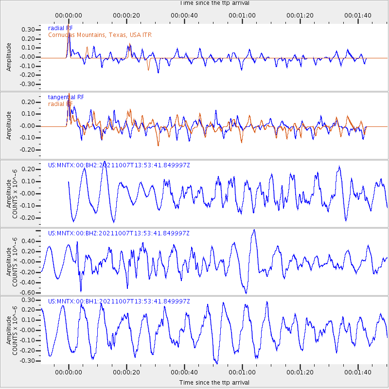
MNTX Cornudas Mountains, Texas, USA - Earthquake Result Viewer
*The percent match for this event was below the threshold and hence no stack was calculated.
| Earthquake location: |
Near East Coast Of Honshu, Japan |
| Earthquake latitude/longitude: |
35.6/140.1 |
| Earthquake time(UTC): |
2021/10/07 (280) 13:41:24 GMT |
| Earthquake Depth: |
62 km |
| Earthquake Magnitude: |
5.9 mww |
| Earthquake Catalog/Contributor: |
NEIC PDE/us |
|
| Network: |
US United States National Seismic Network |
| Station: |
MNTX Cornudas Mountains, Texas, USA |
| Lat/Lon: |
31.70 N/105.38 W |
| Elevation: |
405 m |
|
| Distance: |
89.2 deg |
| Az: |
50.865 deg |
| Baz: |
312.108 deg |
| Ray Param: |
$rayparam |
*The percent match for this event was below the threshold and hence was not used in the summary stack. |
|
| Radial Match: |
63.941154 % |
| Radial Bump: |
400 |
| Transverse Match: |
65.88457 % |
| Transverse Bump: |
393 |
| SOD ConfigId: |
25131211 |
| Insert Time: |
2021-10-21 14:09:27.947 +0000 |
| GWidth: |
2.5 |
| Max Bumps: |
400 |
| Tol: |
0.001 |
|
Signal To Noise
| Channel | StoN | STA | LTA |
| US:MNTX:00:BHZ:20211007T13:53:41.849997Z | 2.2416286 | 2.5857022E-7 | 1.1534928E-7 |
| US:MNTX:00:BH1:20211007T13:53:41.849997Z | 1.2224153 | 1.6709491E-7 | 1.3669242E-7 |
| US:MNTX:00:BH2:20211007T13:53:41.849997Z | 0.6758731 | 8.5566995E-8 | 1.2660216E-7 |
| Arrivals |
| Ps | |
| PpPs | |
| PsPs/PpSs | |


