You are here: Home > Network List > US - United States National Seismic Network Stations List
> Station MSO Missoula, Montana, USA > Earthquake Result Viewer
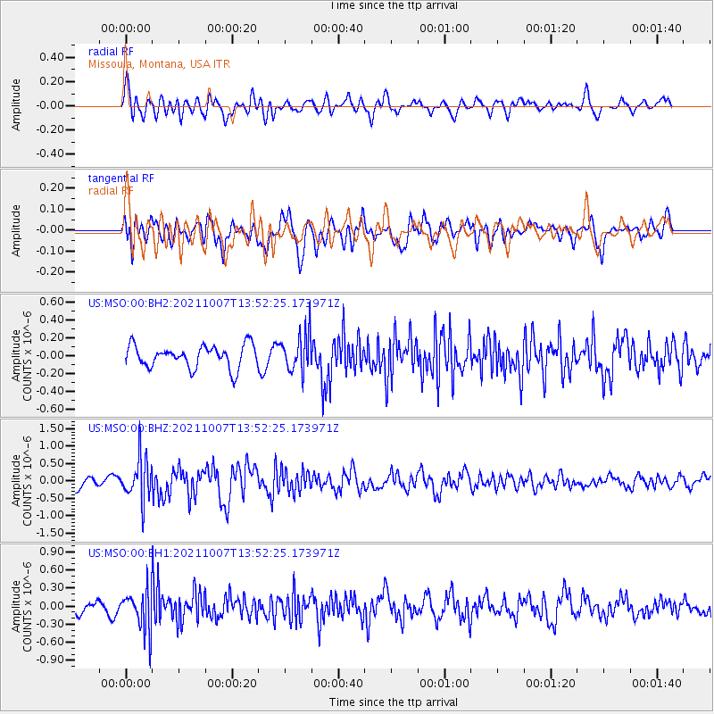
MSO Missoula, Montana, USA - Earthquake Result Viewer
*The percent match for this event was below the threshold and hence no stack was calculated.
| Earthquake location: |
Near East Coast Of Honshu, Japan |
| Earthquake latitude/longitude: |
35.6/140.1 |
| Earthquake time(UTC): |
2021/10/07 (280) 13:41:24 GMT |
| Earthquake Depth: |
62 km |
| Earthquake Magnitude: |
5.9 mww |
| Earthquake Catalog/Contributor: |
NEIC PDE/us |
|
| Network: |
US United States National Seismic Network |
| Station: |
MSO Missoula, Montana, USA |
| Lat/Lon: |
46.83 N/113.94 W |
| Elevation: |
1264 m |
|
| Distance: |
74.5 deg |
| Az: |
43.241 deg |
| Baz: |
305.567 deg |
| Ray Param: |
$rayparam |
*The percent match for this event was below the threshold and hence was not used in the summary stack. |
|
| Radial Match: |
74.478096 % |
| Radial Bump: |
400 |
| Transverse Match: |
60.750374 % |
| Transverse Bump: |
400 |
| SOD ConfigId: |
25131211 |
| Insert Time: |
2021-10-21 14:09:30.339 +0000 |
| GWidth: |
2.5 |
| Max Bumps: |
400 |
| Tol: |
0.001 |
|
Signal To Noise
| Channel | StoN | STA | LTA |
| US:MSO:00:BHZ:20211007T13:52:25.173971Z | 3.3596876 | 6.0344104E-7 | 1.7961226E-7 |
| US:MSO:00:BH1:20211007T13:52:25.173971Z | 2.384427 | 3.2429995E-7 | 1.3600749E-7 |
| US:MSO:00:BH2:20211007T13:52:25.173971Z | 1.717288 | 2.1588963E-7 | 1.2571545E-7 |
| Arrivals |
| Ps | |
| PpPs | |
| PsPs/PpSs | |


