PHID YL.PHID - Earthquake Result Viewer
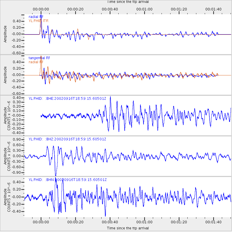
Earthquake location: Iceland Region
Earthquake latitude/longitude: 66.9/-18.5
Earthquake time(UTC): 2002/09/16 (259) 18:48:26 GMT
Earthquake Depth: 10 km
Earthquake Magnitude: 5.5 MB, 5.7 MS, 5.8 MW, 5.8 MW
Earthquake Catalog/Contributor: WHDF/NEIC
Network: YL Himalayan Nepal Tibet Experiment
Station: PHID YL.PHID
Lat/Lon: 27.15 N/87.76 E
Elevation: 1176 m
Distance: 71.4 deg
Az: 64.527 deg
Baz: 336.475 deg
Ray Param: 0.054360796
Estimated Moho Depth: 40.25 km
Estimated Crust Vp/Vs: 1.60
Assumed Crust Vp: 6.236 km/s
Estimated Crust Vs: 3.897 km/s
Estimated Crust Poisson's Ratio: 0.18
Radial Match: 89.719025 %
Radial Bump: 400
Transverse Match: 75.008224 %
Transverse Bump: 400
SOD ConfigId: 16844
Insert Time: 2010-02-26 16:04:29.442 +0000
GWidth: 2.5
Max Bumps: 400
Tol: 0.001

Signal To Noise

ChannelStoNSTALTA
YL:PHID: :BHZ:20020916T18:59:15.60501Z4.19260452.0711443E-74.9399944E-8
YL:PHID: :BHN:20020916T18:59:15.60501Z1.88410888.472795E-84.4969777E-8
YL:PHID: :BHE:20020916T18:59:15.60501Z1.74102684.9017135E-82.8154155E-8
Arrivals
Ps4.0 SECOND
PpPs16 SECOND
PsPs/PpSs20 SECOND