You are here: Home > Network List > WY - Yellowstone Wyoming Seismic Network Stations List
> Station YUF Upper Falls, WY, USA > Earthquake Result Viewer
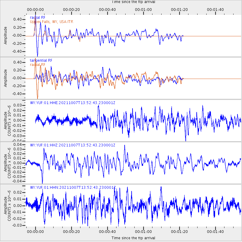
YUF Upper Falls, WY, USA - Earthquake Result Viewer
*The percent match for this event was below the threshold and hence no stack was calculated.
| Earthquake location: |
Near East Coast Of Honshu, Japan |
| Earthquake latitude/longitude: |
35.6/140.1 |
| Earthquake time(UTC): |
2021/10/07 (280) 13:41:24 GMT |
| Earthquake Depth: |
62 km |
| Earthquake Magnitude: |
5.9 mww |
| Earthquake Catalog/Contributor: |
NEIC PDE/us |
|
| Network: |
WY Yellowstone Wyoming Seismic Network |
| Station: |
YUF Upper Falls, WY, USA |
| Lat/Lon: |
44.71 N/110.51 W |
| Elevation: |
2394 m |
|
| Distance: |
77.7 deg |
| Az: |
43.504 deg |
| Baz: |
308.08 deg |
| Ray Param: |
$rayparam |
*The percent match for this event was below the threshold and hence was not used in the summary stack. |
|
| Radial Match: |
67.15459 % |
| Radial Bump: |
400 |
| Transverse Match: |
60.01183 % |
| Transverse Bump: |
400 |
| SOD ConfigId: |
25131211 |
| Insert Time: |
2021-10-21 14:12:49.530 +0000 |
| GWidth: |
2.5 |
| Max Bumps: |
400 |
| Tol: |
0.001 |
|
Signal To Noise
| Channel | StoN | STA | LTA |
| WY:YUF:01:HHZ:20211007T13:52:43.230001Z | 4.1527076 | 1.4785387E-8 | 3.560421E-9 |
| WY:YUF:01:HHN:20211007T13:52:43.230001Z | 1.7561551 | 9.826295E-9 | 5.595346E-9 |
| WY:YUF:01:HHE:20211007T13:52:43.230001Z | 1.6593684 | 7.79271E-9 | 4.6961905E-9 |
| Arrivals |
| Ps | |
| PpPs | |
| PsPs/PpSs | |


