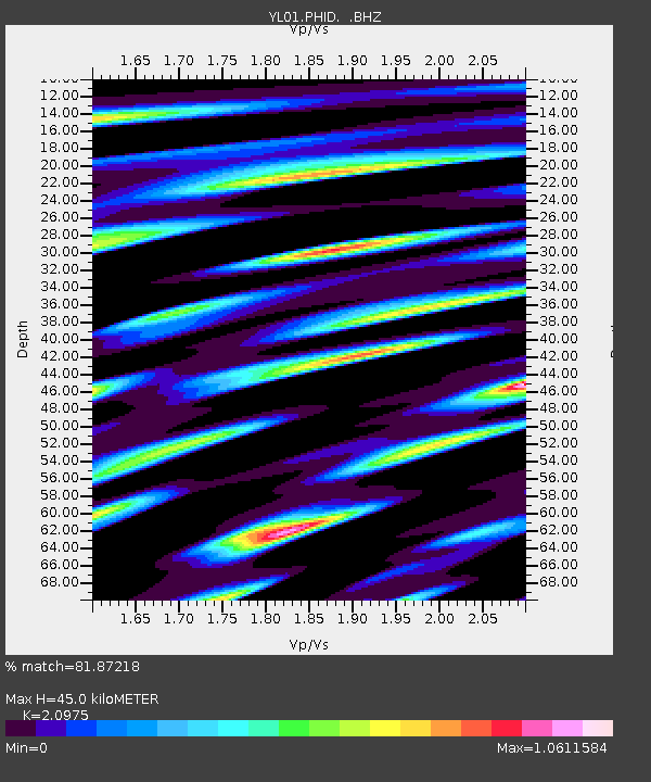
PHID YL.PHID - Earthquake Result Viewer
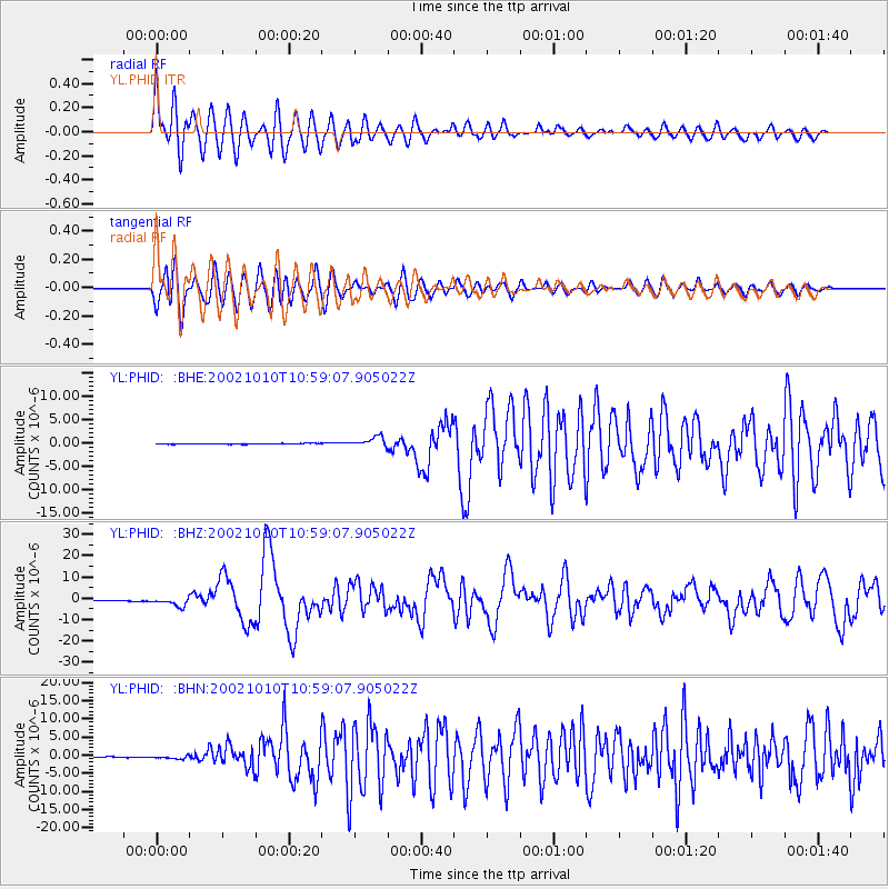
Earthquake location: Irian Jaya Region, Indonesia
Earthquake latitude/longitude: -1.8/134.3
Earthquake time(UTC): 2002/10/10 (283) 10:50:20 GMT
Earthquake Depth: 10 km
Earthquake Magnitude: 6.5 MB, 7.7 MS, 7.6 MW, 7.4 MW
Earthquake Catalog/Contributor: WHDF/NEIC
Network: YL Himalayan Nepal Tibet Experiment
Station: PHID YL.PHID
Lat/Lon: 27.15 N/87.76 E
Elevation: 1176 m
Distance: 53.2 deg
Az: 306.145 deg
Baz: 115.063 deg
Ray Param: 0.066252984
Estimated Moho Depth: 45.0 km
Estimated Crust Vp/Vs: 2.10
Assumed Crust Vp: 6.236 km/s
Estimated Crust Vs: 2.973 km/s
Estimated Crust Poisson's Ratio: 0.35
Radial Match: 81.87218 %
Radial Bump: 400
Transverse Match: 74.17344 %
Transverse Bump: 400
SOD ConfigId: 16844
Insert Time: 2010-02-26 16:04:30.833 +0000
GWidth: 2.5
Max Bumps: 400
Tol: 0.001

Signal To Noise

ChannelStoNSTALTA
YL:PHID: :BHZ:20021010T10:59:07.905022Z13.6251272.0581533E-61.5105572E-7
YL:PHID: :BHN:20021010T10:59:07.905022Z5.29553174.627481E-78.7384635E-8
YL:PHID: :BHE:20021010T10:59:07.905022Z13.0949841.0509807E-68.025826E-8
Arrivals
Ps8.3 SECOND
PpPs21 SECOND
PsPs/PpSs30 SECOND