
PHID YL.PHID - Earthquake Result Viewer
| ||||||||||||||||||
| ||||||||||||||||||
| ||||||||||||||||||
|
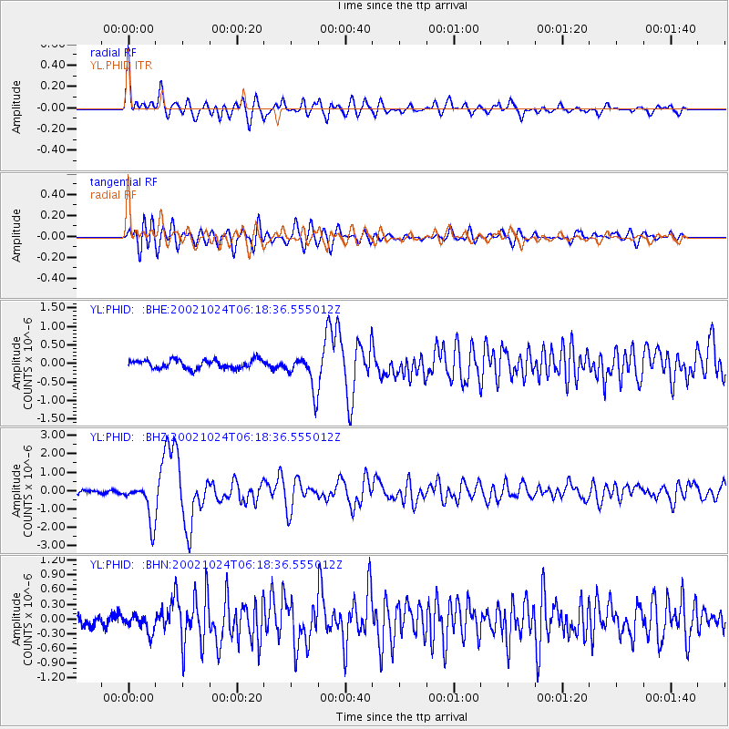
Signal To Noise
| Channel | StoN | STA | LTA |
| YL:PHID: :BHZ:20021024T06:18:36.555012Z | 9.424933 | 1.0665417E-6 | 1.13161725E-7 |
| YL:PHID: :BHN:20021024T06:18:36.555012Z | 1.5550386 | 1.8043313E-7 | 1.1603129E-7 |
| YL:PHID: :BHE:20021024T06:18:36.555012Z | 4.1819386 | 4.8435186E-7 | 1.1581994E-7 |
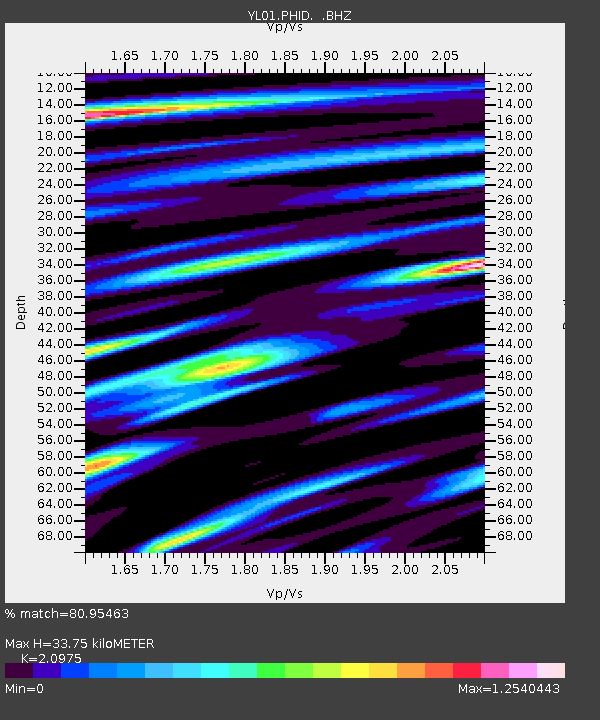
| Arrivals | |
| Ps | 6.1 SECOND |
| PpPs | 16 SECOND |
| PsPs/PpSs | 22 SECOND |

