You are here: Home > Network List > US - United States National Seismic Network Stations List
> Station HAWA Hanford, Washington, USA > Earthquake Result Viewer
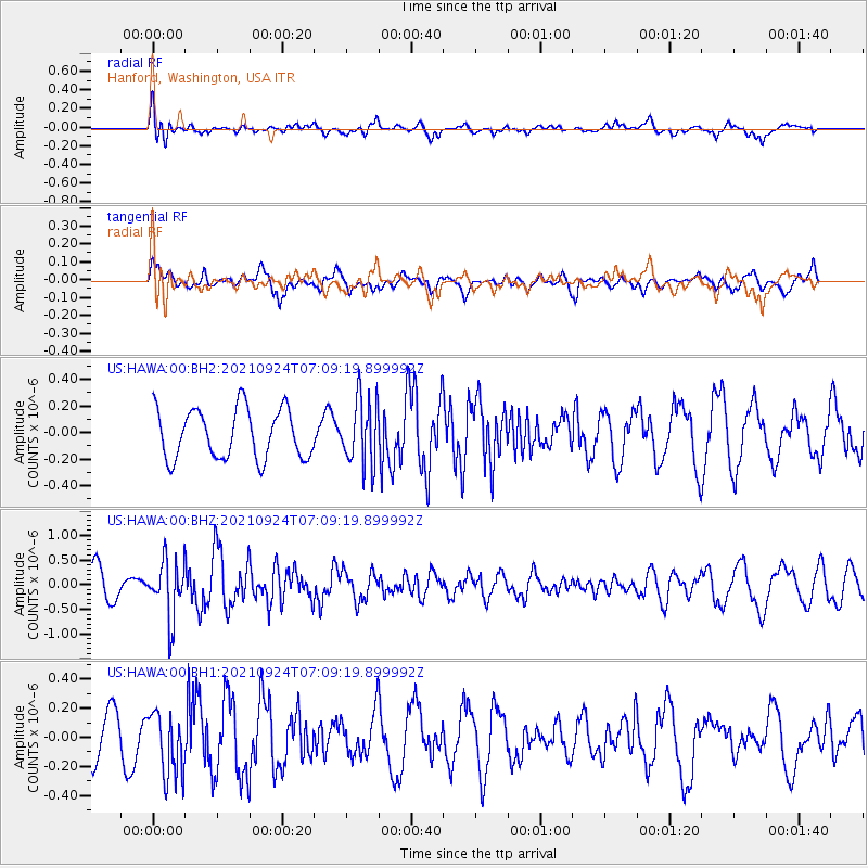
HAWA Hanford, Washington, USA - Earthquake Result Viewer
*The percent match for this event was below the threshold and hence no stack was calculated.
| Earthquake location: |
Andreanof Islands, Aleutian Is. |
| Earthquake latitude/longitude: |
51.1/-179.0 |
| Earthquake time(UTC): |
2021/09/24 (267) 07:02:28 GMT |
| Earthquake Depth: |
18 km |
| Earthquake Magnitude: |
5.5 Mww |
| Earthquake Catalog/Contributor: |
NEIC PDE/us |
|
| Network: |
US United States National Seismic Network |
| Station: |
HAWA Hanford, Washington, USA |
| Lat/Lon: |
46.39 N/119.53 W |
| Elevation: |
364 m |
|
| Distance: |
38.6 deg |
| Az: |
73.036 deg |
| Baz: |
299.467 deg |
| Ray Param: |
$rayparam |
*The percent match for this event was below the threshold and hence was not used in the summary stack. |
|
| Radial Match: |
55.421196 % |
| Radial Bump: |
400 |
| Transverse Match: |
54.6915 % |
| Transverse Bump: |
400 |
| SOD ConfigId: |
26497111 |
| Insert Time: |
2021-10-21 18:15:22.309 +0000 |
| GWidth: |
2.5 |
| Max Bumps: |
400 |
| Tol: |
0.001 |
|
Signal To Noise
| Channel | StoN | STA | LTA |
| US:HAWA:00:BHZ:20210924T07:09:19.899992Z | 2.0578623 | 5.7561704E-7 | 2.7971603E-7 |
| US:HAWA:00:BH1:20210924T07:09:19.899992Z | 1.8968502 | 2.1961544E-7 | 1.1577901E-7 |
| US:HAWA:00:BH2:20210924T07:09:19.899992Z | 1.3326548 | 2.496314E-7 | 1.8731886E-7 |
| Arrivals |
| Ps | |
| PpPs | |
| PsPs/PpSs | |


