You are here: Home > Network List > US - United States National Seismic Network Stations List
> Station AMTX Amarillo, Texas, USA > Earthquake Result Viewer
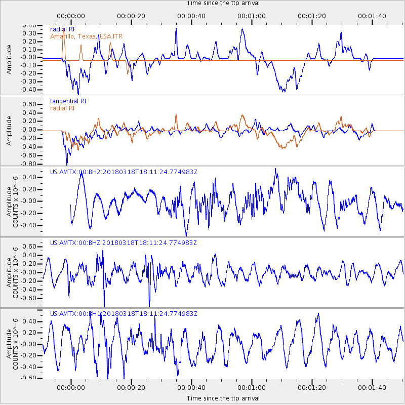
AMTX Amarillo, Texas, USA - Earthquake Result Viewer
*The percent match for this event was below the threshold and hence no stack was calculated.
| Earthquake location: |
Kuril Islands |
| Earthquake latitude/longitude: |
45.3/150.3 |
| Earthquake time(UTC): |
2018/03/18 (077) 18:00:10 GMT |
| Earthquake Depth: |
72 km |
| Earthquake Magnitude: |
5.1 Mww |
| Earthquake Catalog/Contributor: |
NEIC PDE/us |
|
| Network: |
US United States National Seismic Network |
| Station: |
AMTX Amarillo, Texas, USA |
| Lat/Lon: |
34.53 N/101.41 W |
| Elevation: |
1010 m |
|
| Distance: |
77.5 deg |
| Az: |
53.419 deg |
| Baz: |
316.679 deg |
| Ray Param: |
$rayparam |
*The percent match for this event was below the threshold and hence was not used in the summary stack. |
|
| Radial Match: |
42.782585 % |
| Radial Bump: |
400 |
| Transverse Match: |
60.61547 % |
| Transverse Bump: |
400 |
| SOD ConfigId: |
2643891 |
| Insert Time: |
2018-04-16 16:18:15.979 +0000 |
| GWidth: |
2.5 |
| Max Bumps: |
400 |
| Tol: |
0.001 |
|
Signal To Noise
| Channel | StoN | STA | LTA |
| US:AMTX:00:BHZ:20180318T18:11:24.774983Z | 1.1142627 | 1.8129488E-7 | 1.627039E-7 |
| US:AMTX:00:BH1:20180318T18:11:24.774983Z | 0.9519685 | 1.8869062E-7 | 1.98211E-7 |
| US:AMTX:00:BH2:20180318T18:11:24.774983Z | 0.8300884 | 1.5328597E-7 | 1.8466223E-7 |
| Arrivals |
| Ps | |
| PpPs | |
| PsPs/PpSs | |


