You are here: Home > Network List > G - GEOSCOPE Stations List
> Station INU Inuyama, Japan > Earthquake Result Viewer
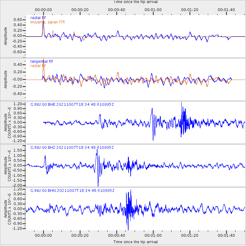
INU Inuyama, Japan - Earthquake Result Viewer
*The percent match for this event was below the threshold and hence no stack was calculated.
| Earthquake location: |
Myanmar |
| Earthquake latitude/longitude: |
22.3/94.8 |
| Earthquake time(UTC): |
2021/10/07 (280) 18:28:03 GMT |
| Earthquake Depth: |
110 km |
| Earthquake Magnitude: |
5.5 mww |
| Earthquake Catalog/Contributor: |
NEIC PDE/us |
|
| Network: |
G GEOSCOPE |
| Station: |
INU Inuyama, Japan |
| Lat/Lon: |
35.35 N/137.03 E |
| Elevation: |
132 m |
|
| Distance: |
39.0 deg |
| Az: |
60.974 deg |
| Baz: |
262.12 deg |
| Ray Param: |
$rayparam |
*The percent match for this event was below the threshold and hence was not used in the summary stack. |
|
| Radial Match: |
69.75261 % |
| Radial Bump: |
400 |
| Transverse Match: |
60.36382 % |
| Transverse Bump: |
400 |
| SOD ConfigId: |
26497111 |
| Insert Time: |
2021-10-21 18:36:26.817 +0000 |
| GWidth: |
2.5 |
| Max Bumps: |
400 |
| Tol: |
0.001 |
|
Signal To Noise
| Channel | StoN | STA | LTA |
| G:INU:00:BHZ:20211007T18:34:48.610995Z | 4.7981453 | 4.072744E-7 | 8.488163E-8 |
| G:INU:00:BHN:20211007T18:34:48.610995Z | 1.6408919 | 1.207115E-7 | 7.3564564E-8 |
| G:INU:00:BHE:20211007T18:34:48.610995Z | 3.1787398 | 2.2613153E-7 | 7.1138736E-8 |
| Arrivals |
| Ps | |
| PpPs | |
| PsPs/PpSs | |


