You are here: Home > Network List > G - GEOSCOPE Stations List
> Station TAM Tamanrasset, Algeria > Earthquake Result Viewer
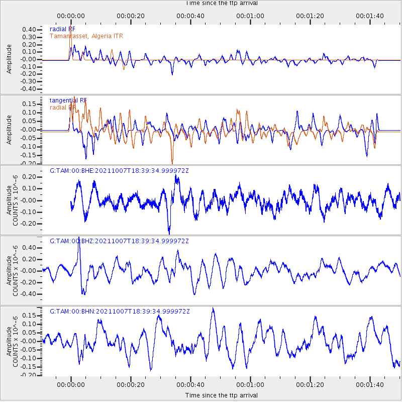
TAM Tamanrasset, Algeria - Earthquake Result Viewer
*The percent match for this event was below the threshold and hence no stack was calculated.
| Earthquake location: |
Myanmar |
| Earthquake latitude/longitude: |
22.3/94.8 |
| Earthquake time(UTC): |
2021/10/07 (280) 18:28:03 GMT |
| Earthquake Depth: |
110 km |
| Earthquake Magnitude: |
5.5 mww |
| Earthquake Catalog/Contributor: |
NEIC PDE/us |
|
| Network: |
G GEOSCOPE |
| Station: |
TAM Tamanrasset, Algeria |
| Lat/Lon: |
22.79 N/5.53 E |
| Elevation: |
1377 m |
|
| Distance: |
81.0 deg |
| Az: |
290.881 deg |
| Baz: |
69.646 deg |
| Ray Param: |
$rayparam |
*The percent match for this event was below the threshold and hence was not used in the summary stack. |
|
| Radial Match: |
61.422615 % |
| Radial Bump: |
400 |
| Transverse Match: |
57.165314 % |
| Transverse Bump: |
400 |
| SOD ConfigId: |
26497111 |
| Insert Time: |
2021-10-21 18:36:30.692 +0000 |
| GWidth: |
2.5 |
| Max Bumps: |
400 |
| Tol: |
0.001 |
|
Signal To Noise
| Channel | StoN | STA | LTA |
| G:TAM:00:BHZ:20211007T18:39:34.999972Z | 3.0210156 | 2.6491287E-7 | 8.7690005E-8 |
| G:TAM:00:BHN:20211007T18:39:34.999972Z | 0.86530983 | 5.440056E-8 | 6.28683E-8 |
| G:TAM:00:BHE:20211007T18:39:34.999972Z | 1.6070521 | 1.1189322E-7 | 6.962639E-8 |
| Arrivals |
| Ps | |
| PpPs | |
| PsPs/PpSs | |


