You are here: Home > Network List > AK - Alaska Regional Network Stations List
> Station MDM Murphy Dome > Earthquake Result Viewer
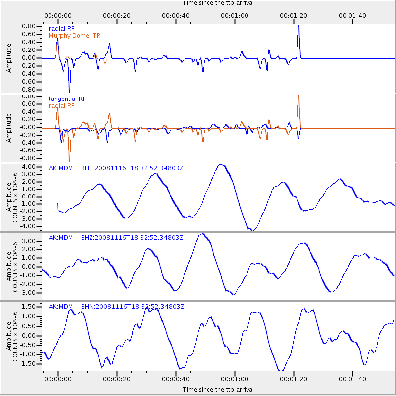
MDM Murphy Dome - Earthquake Result Viewer
*The percent match for this event was below the threshold and hence no stack was calculated.
| Earthquake location: |
Minahassa Peninsula, Sulawesi |
| Earthquake latitude/longitude: |
1.1/121.8 |
| Earthquake time(UTC): |
2008/11/16 (321) 18:20:32 GMT |
| Earthquake Depth: |
35 km |
| Earthquake Magnitude: |
5.5 MB |
| Earthquake Catalog/Contributor: |
WHDF/NEIC |
|
| Network: |
AK Alaska Regional Network |
| Station: |
MDM Murphy Dome |
| Lat/Lon: |
64.96 N/148.23 W |
| Elevation: |
634 m |
|
| Distance: |
89.0 deg |
| Az: |
25.193 deg |
| Baz: |
270.473 deg |
| Ray Param: |
$rayparam |
*The percent match for this event was below the threshold and hence was not used in the summary stack. |
|
| Radial Match: |
83.00301 % |
| Radial Bump: |
400 |
| Transverse Match: |
68.47232 % |
| Transverse Bump: |
399 |
| SOD ConfigId: |
2658 |
| Insert Time: |
2010-03-09 13:30:12.087 +0000 |
| GWidth: |
2.5 |
| Max Bumps: |
400 |
| Tol: |
0.001 |
|
Signal To Noise
| Channel | StoN | STA | LTA |
| AK:MDM: :BHZ:20081116T18:32:52.34803Z | 0.8961191 | 8.5665334E-7 | 9.559592E-7 |
| AK:MDM: :BHN:20081116T18:32:52.34803Z | 0.8865541 | 8.0801397E-7 | 9.114096E-7 |
| AK:MDM: :BHE:20081116T18:32:52.34803Z | 2.146314 | 3.1493641E-6 | 1.4673362E-6 |
| Arrivals |
| Ps | |
| PpPs | |
| PsPs/PpSs | |


