You are here: Home > Network List > C8 - Canadian Seismic Research Network () Stations List
> Station GRIB Gribbell Island, BC, CA > Earthquake Result Viewer
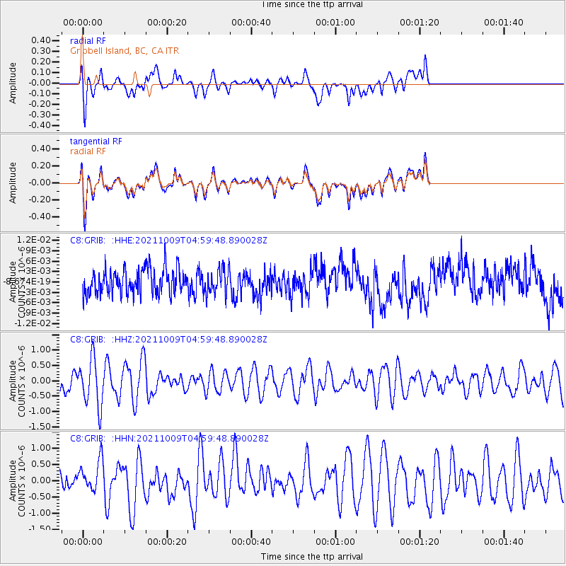
GRIB Gribbell Island, BC, CA - Earthquake Result Viewer
*The percent match for this event was below the threshold and hence no stack was calculated.
| Earthquake location: |
Southern Peru |
| Earthquake latitude/longitude: |
-15.6/-71.9 |
| Earthquake time(UTC): |
2021/10/09 (282) 04:47:50 GMT |
| Earthquake Depth: |
24 km |
| Earthquake Magnitude: |
5.6 mww |
| Earthquake Catalog/Contributor: |
NEIC PDE/us |
|
| Network: |
C8 Canadian Seismic Research Network () |
| Station: |
GRIB Gribbell Island, BC, CA |
| Lat/Lon: |
53.34 N/129.14 W |
| Elevation: |
418 m |
|
| Distance: |
84.3 deg |
| Az: |
329.537 deg |
| Baz: |
125.439 deg |
| Ray Param: |
$rayparam |
*The percent match for this event was below the threshold and hence was not used in the summary stack. |
|
| Radial Match: |
44.98422 % |
| Radial Bump: |
400 |
| Transverse Match: |
44.76568 % |
| Transverse Bump: |
400 |
| SOD ConfigId: |
26497111 |
| Insert Time: |
2021-10-23 04:51:01.348 +0000 |
| GWidth: |
2.5 |
| Max Bumps: |
400 |
| Tol: |
0.001 |
|
Signal To Noise
| Channel | StoN | STA | LTA |
| C8:GRIB: :HHZ:20211009T04:59:48.890028Z | 2.9716399 | 7.9115074E-7 | 2.662337E-7 |
| C8:GRIB: :HHN:20211009T04:59:48.890028Z | 0.7733596 | 4.7917695E-7 | 6.1960435E-7 |
| C8:GRIB: :HHE:20211009T04:59:48.890028Z | 0.98562646 | 3.5331458E-9 | 3.5846701E-9 |
| Arrivals |
| Ps | |
| PpPs | |
| PsPs/PpSs | |


