You are here: Home > Network List > IW - Intermountain West Stations List
> Station MOOW Moose Ponds, Wyoming, USA > Earthquake Result Viewer
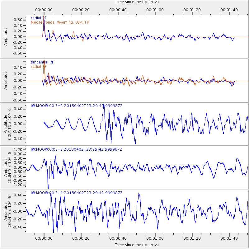
MOOW Moose Ponds, Wyoming, USA - Earthquake Result Viewer
*The percent match for this event was below the threshold and hence no stack was calculated.
| Earthquake location: |
El Salvador |
| Earthquake latitude/longitude: |
13.1/-88.7 |
| Earthquake time(UTC): |
2018/04/02 (092) 23:23:17 GMT |
| Earthquake Depth: |
50 km |
| Earthquake Magnitude: |
5.9 Mww |
| Earthquake Catalog/Contributor: |
NEIC PDE/us |
|
| Network: |
IW Intermountain West |
| Station: |
MOOW Moose Ponds, Wyoming, USA |
| Lat/Lon: |
43.75 N/110.74 W |
| Elevation: |
2128 m |
|
| Distance: |
35.9 deg |
| Az: |
332.374 deg |
| Baz: |
141.435 deg |
| Ray Param: |
$rayparam |
*The percent match for this event was below the threshold and hence was not used in the summary stack. |
|
| Radial Match: |
73.59425 % |
| Radial Bump: |
400 |
| Transverse Match: |
53.2619 % |
| Transverse Bump: |
400 |
| SOD ConfigId: |
2643891 |
| Insert Time: |
2018-04-16 23:25:25.384 +0000 |
| GWidth: |
2.5 |
| Max Bumps: |
400 |
| Tol: |
0.001 |
|
Signal To Noise
| Channel | StoN | STA | LTA |
| IW:MOOW:00:BHZ:20180402T23:29:42.999987Z | 5.8694754 | 5.433054E-7 | 9.256457E-8 |
| IW:MOOW:00:BH1:20180402T23:29:42.999987Z | 2.7826407 | 1.8897568E-7 | 6.791235E-8 |
| IW:MOOW:00:BH2:20180402T23:29:42.999987Z | 2.677089 | 2.568664E-7 | 9.594989E-8 |
| Arrivals |
| Ps | |
| PpPs | |
| PsPs/PpSs | |


