You are here: Home > Network List > US - United States National Seismic Network Stations List
> Station MNTX Cornudas Mountains, Texas, USA > Earthquake Result Viewer
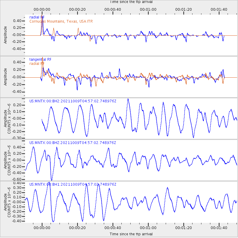
MNTX Cornudas Mountains, Texas, USA - Earthquake Result Viewer
*The percent match for this event was below the threshold and hence no stack was calculated.
| Earthquake location: |
Southern Peru |
| Earthquake latitude/longitude: |
-15.6/-71.9 |
| Earthquake time(UTC): |
2021/10/09 (282) 04:47:50 GMT |
| Earthquake Depth: |
24 km |
| Earthquake Magnitude: |
5.6 mww |
| Earthquake Catalog/Contributor: |
NEIC PDE/us |
|
| Network: |
US United States National Seismic Network |
| Station: |
MNTX Cornudas Mountains, Texas, USA |
| Lat/Lon: |
31.70 N/105.38 W |
| Elevation: |
405 m |
|
| Distance: |
57.0 deg |
| Az: |
325.838 deg |
| Baz: |
140.591 deg |
| Ray Param: |
$rayparam |
*The percent match for this event was below the threshold and hence was not used in the summary stack. |
|
| Radial Match: |
65.68779 % |
| Radial Bump: |
400 |
| Transverse Match: |
56.990574 % |
| Transverse Bump: |
400 |
| SOD ConfigId: |
26497111 |
| Insert Time: |
2021-10-23 05:03:02.458 +0000 |
| GWidth: |
2.5 |
| Max Bumps: |
400 |
| Tol: |
0.001 |
|
Signal To Noise
| Channel | StoN | STA | LTA |
| US:MNTX:00:BHZ:20211009T04:57:02.748976Z | 1.2403184 | 1.6961371E-7 | 1.3675013E-7 |
| US:MNTX:00:BH1:20211009T04:57:02.748976Z | 2.4289248 | 2.7032064E-7 | 1.1129231E-7 |
| US:MNTX:00:BH2:20211009T04:57:02.748976Z | 0.47330195 | 6.4091104E-8 | 1.3541272E-7 |
| Arrivals |
| Ps | |
| PpPs | |
| PsPs/PpSs | |


