You are here: Home > Network List > UW - Pacific Northwest Regional Seismic Network Stations List
> Station UMAT Pilot Rock, OR, USA > Earthquake Result Viewer
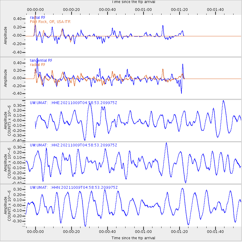
UMAT Pilot Rock, OR, USA - Earthquake Result Viewer
*The percent match for this event was below the threshold and hence no stack was calculated.
| Earthquake location: |
Southern Peru |
| Earthquake latitude/longitude: |
-15.6/-71.9 |
| Earthquake time(UTC): |
2021/10/09 (282) 04:47:50 GMT |
| Earthquake Depth: |
24 km |
| Earthquake Magnitude: |
5.6 mww |
| Earthquake Catalog/Contributor: |
NEIC PDE/us |
|
| Network: |
UW Pacific Northwest Regional Seismic Network |
| Station: |
UMAT Pilot Rock, OR, USA |
| Lat/Lon: |
45.29 N/118.96 W |
| Elevation: |
1318 m |
|
| Distance: |
74.1 deg |
| Az: |
327.476 deg |
| Baz: |
132.776 deg |
| Ray Param: |
$rayparam |
*The percent match for this event was below the threshold and hence was not used in the summary stack. |
|
| Radial Match: |
32.591045 % |
| Radial Bump: |
259 |
| Transverse Match: |
77.42478 % |
| Transverse Bump: |
400 |
| SOD ConfigId: |
26497111 |
| Insert Time: |
2021-10-23 05:04:02.823 +0000 |
| GWidth: |
2.5 |
| Max Bumps: |
400 |
| Tol: |
0.001 |
|
Signal To Noise
| Channel | StoN | STA | LTA |
| UW:UMAT: :HHZ:20211009T04:58:53.209975Z | 1.6940533 | 1.8263106E-7 | 1.0780715E-7 |
| UW:UMAT: :HHN:20211009T04:58:53.209975Z | 1.1557584 | 1.2720251E-7 | 1.1005978E-7 |
| UW:UMAT: :HHE:20211009T04:58:53.209975Z | 2.405189 | 2.291698E-7 | 9.528141E-8 |
| Arrivals |
| Ps | |
| PpPs | |
| PsPs/PpSs | |


