TNA Tin City Broadband - Earthquake Result Viewer
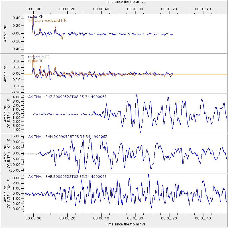
Earthquake location: North Of Honduras
Earthquake latitude/longitude: 16.7/-86.2
Earthquake time(UTC): 2009/05/28 (148) 08:24:45 GMT
Earthquake Depth: 10 km
Earthquake Magnitude: 6.7 MB, 7.2 MS, 7.3 MW, 7.3 MW
Earthquake Catalog/Contributor: WHDF/NEIC
Network: AK Alaska Regional Network
Station: TNA Tin City Broadband
Lat/Lon: 65.56 N/167.92 W
Elevation: 74 m
Distance: 71.5 deg
Az: 334.269 deg
Baz: 90.421 deg
Ray Param: 0.054299563
Estimated Moho Depth: 29.0 km
Estimated Crust Vp/Vs: 1.88
Assumed Crust Vp: 6.307 km/s
Estimated Crust Vs: 3.355 km/s
Estimated Crust Poisson's Ratio: 0.30
Radial Match: 97.73251 %
Radial Bump: 270
Transverse Match: 88.59139 %
Transverse Bump: 400
SOD ConfigId: 2648
Insert Time: 2010-03-09 13:31:07.813 +0000
GWidth: 2.5
Max Bumps: 400
Tol: 0.001

Signal To Noise

ChannelStoNSTALTA
AK:TNA: :BHN:20090528T08:35:34.499006Z4.07246735.2881535E-71.2985134E-7
AK:TNA: :BHE:20090528T08:35:34.499006Z1.09437261.6371985E-71.4960156E-7
AK:TNA: :BHZ:20090528T08:35:34.499006Z2.53146391.3828016E-75.462458E-8
Arrivals
Ps4.2 SECOND
PpPs13 SECOND
PsPs/PpSs17 SECOND