You are here: Home > Network List > CI - Caltech Regional Seismic Network Stations List
> Station BAR Barrett, Tecate, CA, USA > Earthquake Result Viewer
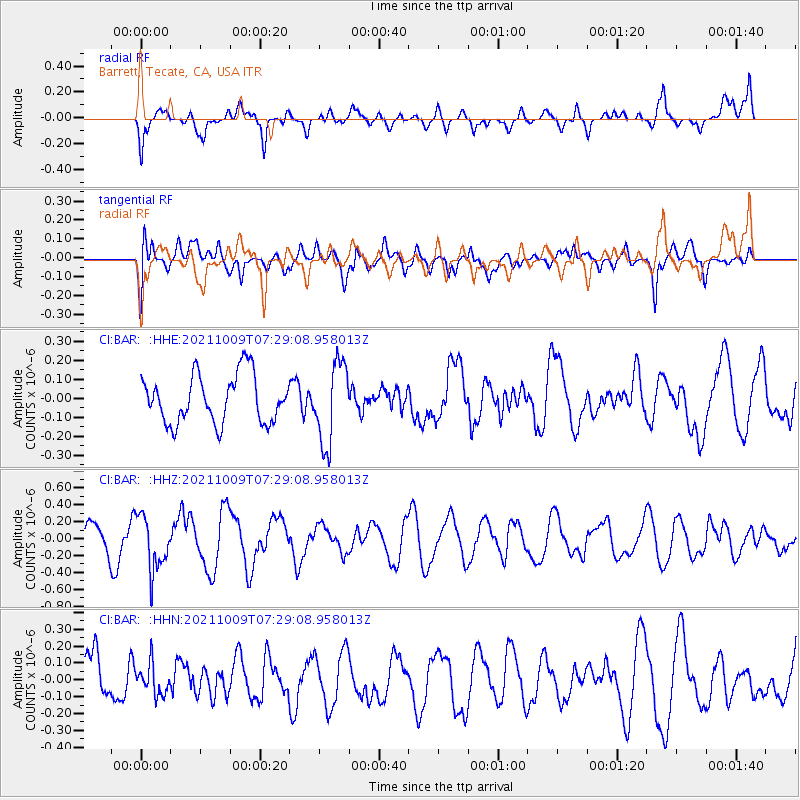
BAR Barrett, Tecate, CA, USA - Earthquake Result Viewer
*The percent match for this event was below the threshold and hence no stack was calculated.
| Earthquake location: |
Sea Of Okhotsk |
| Earthquake latitude/longitude: |
50.0/149.8 |
| Earthquake time(UTC): |
2021/10/09 (282) 07:19:27 GMT |
| Earthquake Depth: |
448 km |
| Earthquake Magnitude: |
5.6 Mww |
| Earthquake Catalog/Contributor: |
NEIC PDE/us |
|
| Network: |
CI Caltech Regional Seismic Network |
| Station: |
BAR Barrett, Tecate, CA, USA |
| Lat/Lon: |
32.68 N/116.67 W |
| Elevation: |
521 m |
|
| Distance: |
67.8 deg |
| Az: |
65.372 deg |
| Baz: |
315.968 deg |
| Ray Param: |
$rayparam |
*The percent match for this event was below the threshold and hence was not used in the summary stack. |
|
| Radial Match: |
57.392498 % |
| Radial Bump: |
400 |
| Transverse Match: |
51.516766 % |
| Transverse Bump: |
400 |
| SOD ConfigId: |
26497111 |
| Insert Time: |
2021-10-23 07:27:39.408 +0000 |
| GWidth: |
2.5 |
| Max Bumps: |
400 |
| Tol: |
0.001 |
|
Signal To Noise
| Channel | StoN | STA | LTA |
| CI:BAR: :HHZ:20211009T07:29:08.958013Z | 2.5233479 | 3.1810677E-7 | 1.2606536E-7 |
| CI:BAR: :HHN:20211009T07:29:08.958013Z | 0.5726034 | 8.7519716E-8 | 1.5284527E-7 |
| CI:BAR: :HHE:20211009T07:29:08.958013Z | 1.6849254 | 2.1367893E-7 | 1.2681804E-7 |
| Arrivals |
| Ps | |
| PpPs | |
| PsPs/PpSs | |


