TNA Tin City Broadband - Earthquake Result Viewer
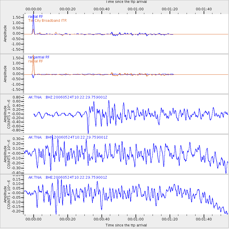
Earthquake location: Near North Coast Of Irian Jaya
Earthquake latitude/longitude: -2.2/139.2
Earthquake time(UTC): 2006/05/24 (144) 10:11:07 GMT
Earthquake Depth: 32 km
Earthquake Magnitude: 5.8 MB, 5.6 MS, 5.7 MW, 5.7 MW
Earthquake Catalog/Contributor: WHDF/NEIC
Network: AK Alaska Regional Network
Station: TNA Tin City Broadband
Lat/Lon: 65.56 N/167.92 W
Elevation: 74 m
Distance: 77.6 deg
Az: 19.871 deg
Baz: 234.723 deg
Ray Param: 0.050188795
Estimated Moho Depth: 54.75 km
Estimated Crust Vp/Vs: 2.07
Assumed Crust Vp: 6.307 km/s
Estimated Crust Vs: 3.043 km/s
Estimated Crust Poisson's Ratio: 0.35
Radial Match: 93.067604 %
Radial Bump: 141
Transverse Match: 74.98341 %
Transverse Bump: 295
SOD ConfigId: 2669
Insert Time: 2010-03-09 13:31:23.181 +0000
GWidth: 2.5
Max Bumps: 400
Tol: 0.001

Signal To Noise

ChannelStoNSTALTA
AK:TNA: :BHN:20060524T10:22:29.759001Z1.81166771.0797125E-75.9597717E-8
AK:TNA: :BHE:20060524T10:22:29.759001Z1.38926455.1783566E-83.7274088E-8
AK:TNA: :BHZ:20060524T10:22:29.759001Z4.92666533.3059987E-76.710419E-8
Arrivals
Ps9.5 SECOND
PpPs26 SECOND
PsPs/PpSs36 SECOND