
TNA Tin City Broadband - Earthquake Result Viewer
| ||||||||||||||||||
| ||||||||||||||||||
| ||||||||||||||||||
|
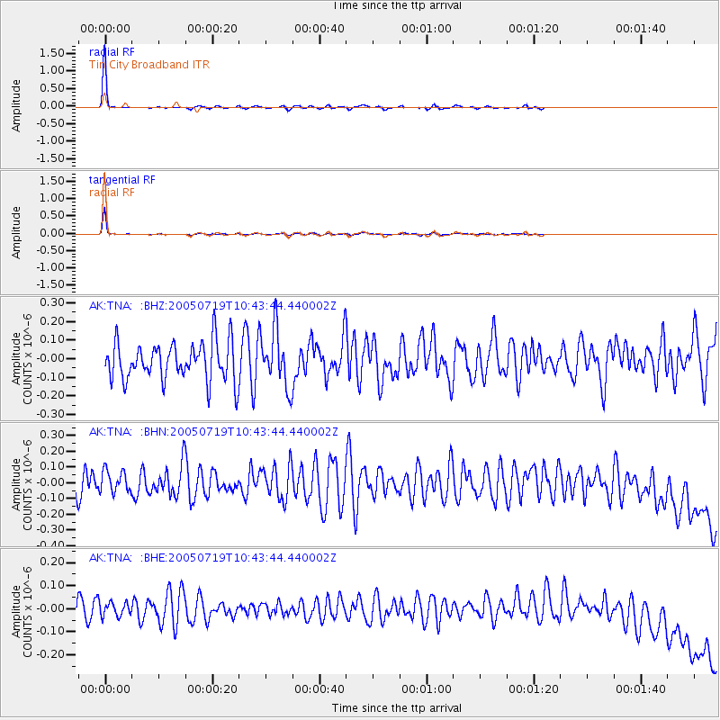
Signal To Noise
| Channel | StoN | STA | LTA |
| AK:TNA: :BHN:20050719T10:43:44.440002Z | 1.081262 | 7.045761E-8 | 6.5162375E-8 |
| AK:TNA: :BHE:20050719T10:43:44.440002Z | 0.652085 | 2.963849E-8 | 4.545188E-8 |
| AK:TNA: :BHZ:20050719T10:43:44.440002Z | 1.4890689 | 1.5211563E-7 | 1.02154864E-7 |
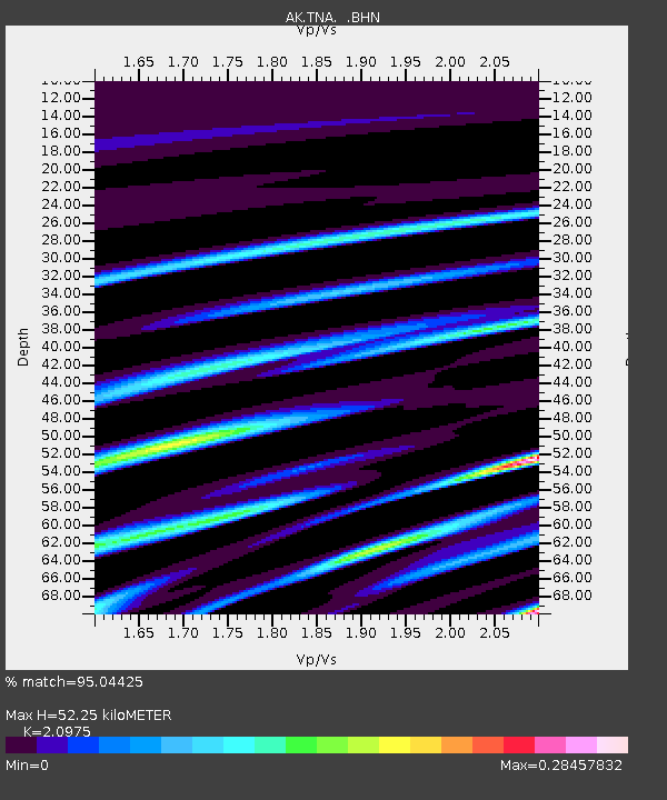
| Arrivals | |
| Ps | 9.3 SECOND |
| PpPs | 25 SECOND |
| PsPs/PpSs | 34 SECOND |

