TNA Tin City Broadband - Earthquake Result Viewer
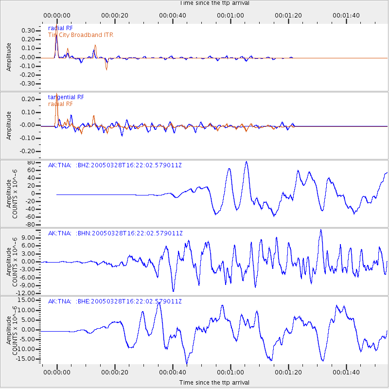
Earthquake location: Northern Sumatra, Indonesia
Earthquake latitude/longitude: 2.1/97.1
Earthquake time(UTC): 2005/03/28 (087) 16:09:36 GMT
Earthquake Depth: 30 km
Earthquake Magnitude: 7.2 MB, 8.4 MS, 8.7 MW, 8.1 MW
Earthquake Catalog/Contributor: WHDF/NEIC
Network: AK Alaska Regional Network
Station: TNA Tin City Broadband
Lat/Lon: 65.56 N/167.92 W
Elevation: 74 m
Distance: 90.2 deg
Az: 24.486 deg
Baz: 275.378 deg
Ray Param: 0.041688345
Estimated Moho Depth: 27.0 km
Estimated Crust Vp/Vs: 2.09
Assumed Crust Vp: 6.307 km/s
Estimated Crust Vs: 3.018 km/s
Estimated Crust Poisson's Ratio: 0.35
Radial Match: 98.22657 %
Radial Bump: 197
Transverse Match: 84.35255 %
Transverse Bump: 400
SOD ConfigId: 2459
Insert Time: 2010-03-09 13:32:38.756 +0000
GWidth: 2.5
Max Bumps: 400
Tol: 0.001

Signal To Noise

ChannelStoNSTALTA
AK:TNA: :BHN:20050328T16:22:02.579011Z1.82207051.9093967E-71.047927E-7
AK:TNA: :BHE:20050328T16:22:02.579011Z4.8525433.0483193E-76.281901E-8
AK:TNA: :BHZ:20050328T16:22:02.579011Z5.8672931.2875261E-62.1944125E-7
Arrivals
Ps4.7 SECOND
PpPs13 SECOND
PsPs/PpSs18 SECOND