You are here: Home > Network List > US - United States National Seismic Network Stations List
> Station GLMI Grayling, Michigan, USA > Earthquake Result Viewer
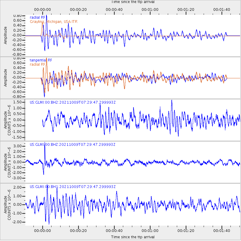
GLMI Grayling, Michigan, USA - Earthquake Result Viewer
*The percent match for this event was below the threshold and hence no stack was calculated.
| Earthquake location: |
Sea Of Okhotsk |
| Earthquake latitude/longitude: |
50.0/149.8 |
| Earthquake time(UTC): |
2021/10/09 (282) 07:19:27 GMT |
| Earthquake Depth: |
448 km |
| Earthquake Magnitude: |
5.6 Mww |
| Earthquake Catalog/Contributor: |
NEIC PDE/us |
|
| Network: |
US United States National Seismic Network |
| Station: |
GLMI Grayling, Michigan, USA |
| Lat/Lon: |
44.82 N/84.62 W |
| Elevation: |
387 m |
|
| Distance: |
74.3 deg |
| Az: |
36.963 deg |
| Baz: |
326.985 deg |
| Ray Param: |
$rayparam |
*The percent match for this event was below the threshold and hence was not used in the summary stack. |
|
| Radial Match: |
65.688995 % |
| Radial Bump: |
400 |
| Transverse Match: |
69.14793 % |
| Transverse Bump: |
400 |
| SOD ConfigId: |
26497111 |
| Insert Time: |
2021-10-23 07:44:41.940 +0000 |
| GWidth: |
2.5 |
| Max Bumps: |
400 |
| Tol: |
0.001 |
|
Signal To Noise
| Channel | StoN | STA | LTA |
| US:GLMI:00:BHZ:20211009T07:29:47.299993Z | 3.775626 | 9.801506E-7 | 2.5959952E-7 |
| US:GLMI:00:BH1:20211009T07:29:47.299993Z | 3.390884 | 1.0271684E-6 | 3.0292054E-7 |
| US:GLMI:00:BH2:20211009T07:29:47.299993Z | 1.5568988 | 5.806563E-7 | 3.72957E-7 |
| Arrivals |
| Ps | |
| PpPs | |
| PsPs/PpSs | |


