TNA Tin City Broadband - Earthquake Result Viewer
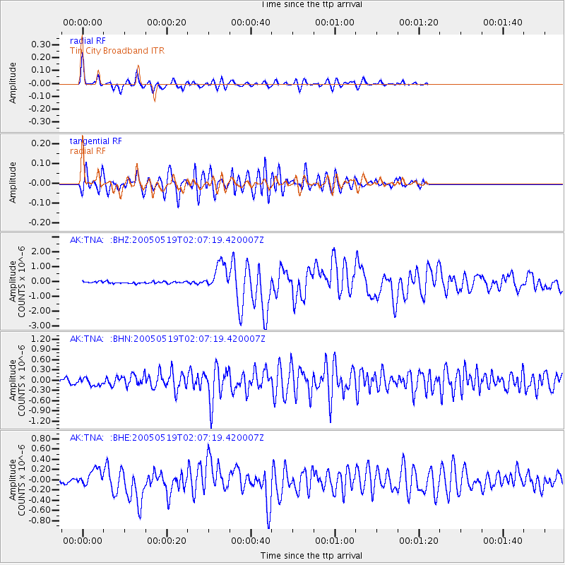
Earthquake location: Northern Sumatra, Indonesia
Earthquake latitude/longitude: 2.0/97.0
Earthquake time(UTC): 2005/05/19 (139) 01:54:52 GMT
Earthquake Depth: 30 km
Earthquake Magnitude: 6.2 MB, 6.9 MS, 6.9 MW, 6.7 MW
Earthquake Catalog/Contributor: WHDF/NEIC
Network: AK Alaska Regional Network
Station: TNA Tin City Broadband
Lat/Lon: 65.56 N/167.92 W
Elevation: 74 m
Distance: 90.3 deg
Az: 24.484 deg
Baz: 275.4 deg
Ray Param: 0.041680176
Estimated Moho Depth: 30.25 km
Estimated Crust Vp/Vs: 1.78
Assumed Crust Vp: 6.307 km/s
Estimated Crust Vs: 3.538 km/s
Estimated Crust Poisson's Ratio: 0.27
Radial Match: 92.459694 %
Radial Bump: 400
Transverse Match: 77.72721 %
Transverse Bump: 400
SOD ConfigId: 263228
Insert Time: 2010-03-09 13:32:44.375 +0000
GWidth: 2.5
Max Bumps: 400
Tol: 0.001

Signal To Noise

ChannelStoNSTALTA
AK:TNA: :BHN:20050519T02:07:19.420007Z1.48369421.07857666E-77.269534E-8
AK:TNA: :BHE:20050519T02:07:19.420007Z5.68659161.6560605E-72.91222E-8
AK:TNA: :BHZ:20050519T02:07:19.420007Z15.3720489.0398873E-75.8807306E-8
Arrivals
Ps3.8 SECOND
PpPs13 SECOND
PsPs/PpSs17 SECOND