You are here: Home > Network List > US - United States National Seismic Network Stations List
> Station OGNE Ogallala, Nebraska, USA > Earthquake Result Viewer
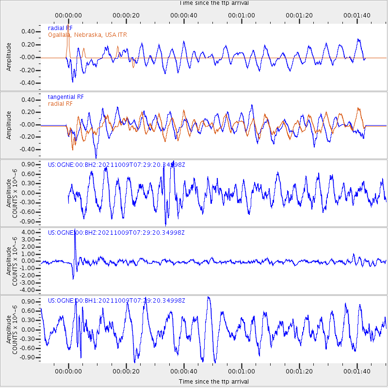
OGNE Ogallala, Nebraska, USA - Earthquake Result Viewer
*The percent match for this event was below the threshold and hence no stack was calculated.
| Earthquake location: |
Sea Of Okhotsk |
| Earthquake latitude/longitude: |
50.0/149.8 |
| Earthquake time(UTC): |
2021/10/09 (282) 07:19:27 GMT |
| Earthquake Depth: |
448 km |
| Earthquake Magnitude: |
5.6 Mww |
| Earthquake Catalog/Contributor: |
NEIC PDE/us |
|
| Network: |
US United States National Seismic Network |
| Station: |
OGNE Ogallala, Nebraska, USA |
| Lat/Lon: |
40.95 N/102.03 W |
| Elevation: |
1054 m |
|
| Distance: |
69.7 deg |
| Az: |
50.131 deg |
| Baz: |
319.205 deg |
| Ray Param: |
$rayparam |
*The percent match for this event was below the threshold and hence was not used in the summary stack. |
|
| Radial Match: |
60.700966 % |
| Radial Bump: |
400 |
| Transverse Match: |
59.39903 % |
| Transverse Bump: |
388 |
| SOD ConfigId: |
26497111 |
| Insert Time: |
2021-10-23 07:45:06.555 +0000 |
| GWidth: |
2.5 |
| Max Bumps: |
400 |
| Tol: |
0.001 |
|
Signal To Noise
| Channel | StoN | STA | LTA |
| US:OGNE:00:BHZ:20211009T07:29:20.34998Z | 6.5332084 | 1.2837077E-6 | 1.9648962E-7 |
| US:OGNE:00:BH1:20211009T07:29:20.34998Z | 1.5467867 | 4.965525E-7 | 3.21022E-7 |
| US:OGNE:00:BH2:20211009T07:29:20.34998Z | 1.16489 | 4.7254403E-7 | 4.056555E-7 |
| Arrivals |
| Ps | |
| PpPs | |
| PsPs/PpSs | |


