You are here: Home > Network List > UW - Pacific Northwest Regional Seismic Network Stations List
> Station UMAT Pilot Rock, OR, USA > Earthquake Result Viewer
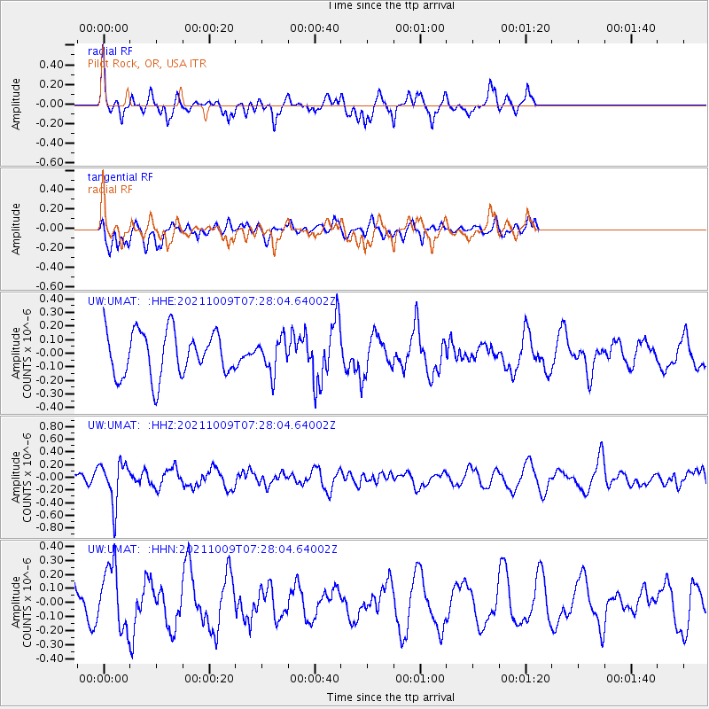
UMAT Pilot Rock, OR, USA - Earthquake Result Viewer
*The percent match for this event was below the threshold and hence no stack was calculated.
| Earthquake location: |
Sea Of Okhotsk |
| Earthquake latitude/longitude: |
50.0/149.8 |
| Earthquake time(UTC): |
2021/10/09 (282) 07:19:27 GMT |
| Earthquake Depth: |
448 km |
| Earthquake Magnitude: |
5.6 Mww |
| Earthquake Catalog/Contributor: |
NEIC PDE/us |
|
| Network: |
UW Pacific Northwest Regional Seismic Network |
| Station: |
UMAT Pilot Rock, OR, USA |
| Lat/Lon: |
45.29 N/118.96 W |
| Elevation: |
1318 m |
|
| Distance: |
57.9 deg |
| Az: |
56.44 deg |
| Baz: |
310.428 deg |
| Ray Param: |
$rayparam |
*The percent match for this event was below the threshold and hence was not used in the summary stack. |
|
| Radial Match: |
64.36682 % |
| Radial Bump: |
309 |
| Transverse Match: |
41.190247 % |
| Transverse Bump: |
361 |
| SOD ConfigId: |
26497111 |
| Insert Time: |
2021-10-23 07:46:37.752 +0000 |
| GWidth: |
2.5 |
| Max Bumps: |
400 |
| Tol: |
0.001 |
|
Signal To Noise
| Channel | StoN | STA | LTA |
| UW:UMAT: :HHZ:20211009T07:28:04.64002Z | 3.69916 | 3.344671E-7 | 9.041704E-8 |
| UW:UMAT: :HHN:20211009T07:28:04.64002Z | 2.5291433 | 2.2211576E-7 | 8.782253E-8 |
| UW:UMAT: :HHE:20211009T07:28:04.64002Z | 0.7484306 | 1.2327428E-7 | 1.6471036E-7 |
| Arrivals |
| Ps | |
| PpPs | |
| PsPs/PpSs | |


