You are here: Home > Network List > IU - Global Seismograph Network (GSN - IRIS/USGS) Stations List
> Station JOHN Johnston Island, USA > Earthquake Result Viewer
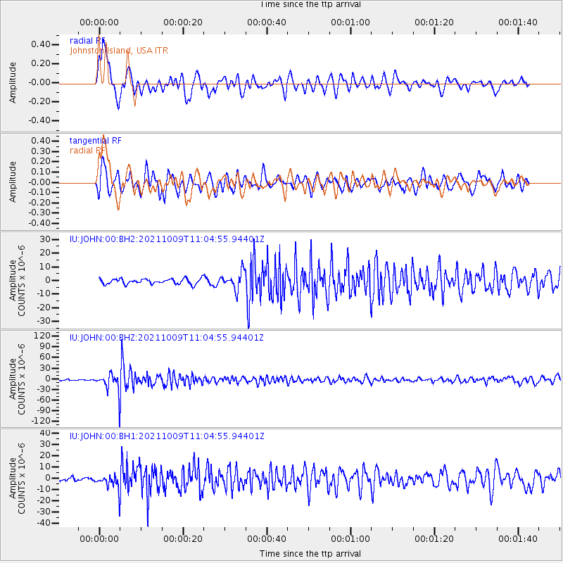
JOHN Johnston Island, USA - Earthquake Result Viewer
*The percent match for this event was below the threshold and hence no stack was calculated.
| Earthquake location: |
Vanuatu Islands Region |
| Earthquake latitude/longitude: |
-21.2/174.5 |
| Earthquake time(UTC): |
2021/10/09 (282) 10:58:30 GMT |
| Earthquake Depth: |
520 km |
| Earthquake Magnitude: |
6.9 mww |
| Earthquake Catalog/Contributor: |
NEIC PDE/us |
|
| Network: |
IU Global Seismograph Network (GSN - IRIS/USGS) |
| Station: |
JOHN Johnston Island, USA |
| Lat/Lon: |
16.73 N/169.53 W |
| Elevation: |
2.0 m |
|
| Distance: |
40.8 deg |
| Az: |
23.759 deg |
| Baz: |
203.106 deg |
| Ray Param: |
$rayparam |
*The percent match for this event was below the threshold and hence was not used in the summary stack. |
|
| Radial Match: |
66.55088 % |
| Radial Bump: |
400 |
| Transverse Match: |
69.973175 % |
| Transverse Bump: |
400 |
| SOD ConfigId: |
26497111 |
| Insert Time: |
2021-10-23 11:14:57.406 +0000 |
| GWidth: |
2.5 |
| Max Bumps: |
400 |
| Tol: |
0.001 |
|
Signal To Noise
| Channel | StoN | STA | LTA |
| IU:JOHN:00:BHZ:20211009T11:04:55.94401Z | 16.454582 | 2.4957813E-5 | 1.5167698E-6 |
| IU:JOHN:00:BH1:20211009T11:04:55.94401Z | 3.8032691 | 6.5130116E-6 | 1.7124772E-6 |
| IU:JOHN:00:BH2:20211009T11:04:55.94401Z | 3.4710338 | 6.5468716E-6 | 1.8861447E-6 |
| Arrivals |
| Ps | |
| PpPs | |
| PsPs/PpSs | |


