You are here: Home > Network List > US - United States National Seismic Network Stations List
> Station AMTX Amarillo, Texas, USA > Earthquake Result Viewer
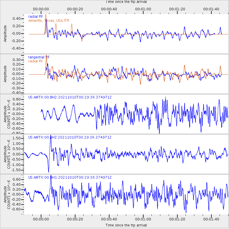
AMTX Amarillo, Texas, USA - Earthquake Result Viewer
*The percent match for this event was below the threshold and hence no stack was calculated.
| Earthquake location: |
Central Peru |
| Earthquake latitude/longitude: |
-11.7/-71.7 |
| Earthquake time(UTC): |
2021/10/10 (283) 00:20:41 GMT |
| Earthquake Depth: |
13 km |
| Earthquake Magnitude: |
5.7 mww |
| Earthquake Catalog/Contributor: |
NEIC PDE/us |
|
| Network: |
US United States National Seismic Network |
| Station: |
AMTX Amarillo, Texas, USA |
| Lat/Lon: |
34.53 N/101.41 W |
| Elevation: |
1010 m |
|
| Distance: |
54.0 deg |
| Az: |
329.612 deg |
| Baz: |
143.125 deg |
| Ray Param: |
$rayparam |
*The percent match for this event was below the threshold and hence was not used in the summary stack. |
|
| Radial Match: |
56.45671 % |
| Radial Bump: |
400 |
| Transverse Match: |
71.32098 % |
| Transverse Bump: |
400 |
| SOD ConfigId: |
26497111 |
| Insert Time: |
2021-10-24 00:41:55.241 +0000 |
| GWidth: |
2.5 |
| Max Bumps: |
400 |
| Tol: |
0.001 |
|
Signal To Noise
| Channel | StoN | STA | LTA |
| US:AMTX:00:BHZ:20211010T00:29:36.374971Z | 3.3225446 | 4.892534E-7 | 1.4725262E-7 |
| US:AMTX:00:BH1:20211010T00:29:36.374971Z | 0.7563124 | 1.2682818E-7 | 1.6769286E-7 |
| US:AMTX:00:BH2:20211010T00:29:36.374971Z | 0.44996807 | 8.521415E-8 | 1.8937821E-7 |
| Arrivals |
| Ps | |
| PpPs | |
| PsPs/PpSs | |


